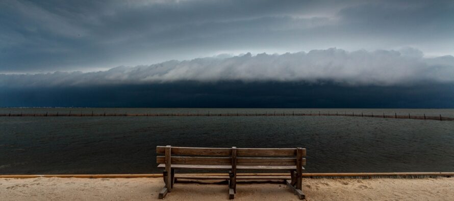
Thunderstorms Break the Humidity. For Now.

Discussion: Since we’re starting off with a stormfront, the weekend outlook will be in article format. First, we’ll cover this evening’s storms then we’ll get into the rest of the weekend and the longer-range foreseeable pattern.
The small and transient trough is swinging into place over NJ at the mid-upper levels. This means a frontal boundary passage at the lower levels later tonight (Friday night) into early Saturday morning…moving through NJ from NW to SE. Just ahead of that frontal boundary will be adequate diurnal instability, vertical wind shear, dew points in the 65-70+F range, and a lifting mechanism of the front itself (it moves forward like a wedge doorstop) to warrant thunderstorm possibility at the surface.
Current radar indicates frontal precipitation and thunderstorms are approaching/just into NWNJ now (as of 2:15pm Friday). The front will push through NJ slowly from NW to SE between now and early Saturday AM. As it does so, downpours and thunderstorms will train along/just ahead of the frontal boundary from SW to NE. With that said, a general but not exact, storm schedule for today is as follows: NWNJ (afternoon through late afternoon), CNJ along 95 (afternoon into early evening), SENJ (early evening into tonight/overnight).
At the very least, all of NJ are on the hook for some breezy showers/downpours to roll through with periodic boomers. NWNJ has much better dynamics than SENJ today. NWNJ is less impacted by subsidence (sinking air) on the NE side of the tropical low off the S Mid-Atlantic US coast. The tropical low will have no impact to NJ (other than some surf). But it should rob SENJ of storm energy while NWNJ goes more unphased. It all points towards areas NW of 95/NJTP seeing more severe storms (higher wind gusts and possible hail/etc.) than areas SE of 95/NJTP…but again all are on the hook for at least something.
The rest of the weekend looks very nice and pleasant. Saturday and Sunday should both peak in the mid-to-upper 70s for most areas (closer to 80-84 away from the ocean and closer to 70-75 along the ocean). The stormfront tonight will cut the humidity and lower dew points to the 50s, maybe even 40s by Sunday. So a beautiful outdoor weekend Saturday and Sunday after tonight’s storms. The pattern through the rest of June looks hot as several ridges look to flex over the E US. I imagine that will come with a few storm fronts, possibly severe outbreaks. But a hazy, hot, and humid pattern awaits after this beautiful weekend passes.
In English: Downpours and thunderstorms will push through NJ over the rest of Friday from NW to SE. They are moving into NWNJ now, should be near I-95 by early-evening, and then clear SENJ later tonight. Breezy rain and rumbles are a confident forecast. Severe winds and frequent lightning will not be seen by all along front, but is possible for some, especially NW of I-95/NJTP. Once this stormfront clears through by midnight-2AM Saturday, the rest of the weekend looks gorgeous…warm summery days (but dry feeling) and cooler spring nights. Slightly breezy but not bad. For a small period (this weekend – for now), the thunderstorms will break the humidity. Pattern looks hot as heck after this weekend to close out June/open up July…hazy, hot, and humid prolonged pattern incoming next week. Be safe! JC.
Premium Services
KABOOM Club offers inside info forecast discussion, your questions answered, and early storm impact maps (ahead of the public). At a buck per month, it’s an extremely feasible way to show support.
My Pocket Meteorologist (MPM), in partnership with EPAWA Weather Consulting, offers professional/commercial interests, whose businesses depend on outdoor weather conditions (snow plowing, landscaping, construction, etc.), with hyper-local text message alerts/forecasts and access to the MPM premium forum—the most comprehensive and technical forecast discussion available for PA and NJ.
Jonathan Carr (JC) is the founder and sole operator of Weather NJ, New Jersey’s largest independent weather reporting agency. Since 2010, Jonathan has provided weather safety discussion and forecasting services for New Jersey and surrounding areas through the web and social media. Originally branded as Severe NJ Weather (before 2014), Weather NJ is proud to bring you accurate and responsible forecast discussion ahead of high-stakes weather scenarios that impact this great garden state of ours. All Weather. All New Jersey.™ Be safe! JC


