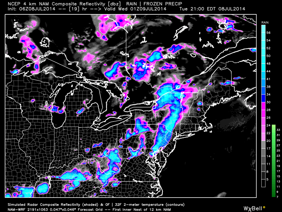
Today will be another hazy hot and humid day with plenty of sunshine. While isolated afternoon t-storms are possible, short-range guidance has a decent amount of storm activity pushing through later this evening. This is the high-res NAM showing simulated radar for 9PM. As usual, it looks like PA will get a nice hit but the higher elevations of the Appalachian Mountains should weaken the storm energy as it approaches western NJ. I would at least expect strong (possibly severe) t-storms to cross the Delaware River but whether or not they fizzle before reaching the coast will be determined during live-casting. Be safe and have a great day! JC
Stormy Night Ahead (July 8-9)
