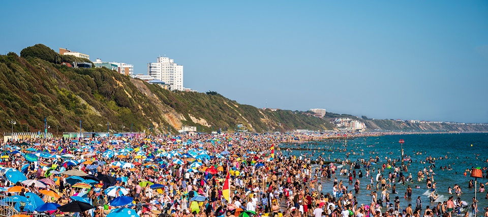
Discussion: Today’s (Thursday) temperatures should max in the 80s, maybe some approaching 90, with a continued humid feel. Showers are possible here and there, much like a tropical environment, but the true relief starts tomorrow (Friday). There might be some showers, even boomers, along the actual cold front overnight tonight (Thursday night) but such would be in and out quick. I’m expecting the front to push through in the 2-4am window with clearing well in-time for sunrise Friday morning. Friday, Saturday, and Sunday then all look great as a trough drops down over the E US with high pressure to the W of NJ supporting cooler and drier northerly flow. With dew point temperatures in the 40s/50s, it’s “open the windows overnight if you can” weather. It’s, dare I say, the first infant breath of the colder season to come in a few months. Don’t run for the coats and gear just yet though. It will still reach into the 80s during the day but still with a dry and pleasant feel. The picture is not of NJ but represents how I feel the beaches might be this weekend lol. Spectacular conditions on-deck for New Jersey this weekend. Humidity should begin trickling back in Sunday PM and stay somewhat elevated next week with unsettled conditions. I’m watching a synoptic system to bring potential widespread rain (much needed) to NJ in the Monday-Tuesday period. Other than that showers and storms are possible on any afternoon/evening. Also it’s probably time to start paying attention to the tropics. There are no current threats to New Jersey or the East Coast, however, the Cape Verde region looks like it’s heating up. Will see what, if anything, can cross the Atlantic towards the W Caribbean. Despite the colder near-shore ocean waters (from upwelling), SSTs are largely above-average off the E US coast. But yeah, time to watch the tropics as we enter peak hurricane season.
Friday (Aug 12) high temperatures should reach the low-to-mid 80s with a pleasant feel. Skies should transition from mixed (AM hours) to mostly sunny by afternoon. Winds should be light out of the N/NW. Overnight lows should range from 55-65 from elevations to coasts. With lower humidity this should feel very refreshing.
Saturday (Aug 13) high temperatures should reach the low-to-mid 80s with a pleasant feel. Skies should be mostly sunny. Winds should be light out of the N. Overnight lows should again range from 55-65 from elevations to coasts.
Sunday (Aug 14) high temperatures should reach the mid-80s for most with the pleasant feel extending through at least evening hours. Might see some humidity trickle back in during PM hours. Skies should transition from sun (AM hours) to mixed by afternoon. Winds should be light out of the W/NW. Overnight lows should range from 60-70 from elevations to coasts as rain likely approaches.
An early look at next week indicates temperatures generally in the mid-80s (give or take a few degrees) with a more humid feel. It likely won’t feel suffocating or sweltering like the last few weeks but noticeably more humid than how this weekend will feel. Looks like a few storm chances here and there but most importantly, some much needed widespread rain is possible in the Monday-Tuesday period. Let’s take a closer look at it on Sunday. Everyone have a great weekend, enjoy the much-deserved relief and great weather, and please be safe! JC
Premium Services
KABOOM Club offers inside info forecast discussion, your questions answered, and early storm impact maps (ahead of the public). At a buck per month, it’s an extremely feasible way to show support.
My Pocket Meteorologist (MPM), in partnership with EPAWA Weather Consulting, offers professional/commercial interests, whose businesses depend on outdoor weather conditions (snow plowing, landscaping, construction, etc.), with hyper-local text message alerts/forecasts and access to the MPM premium forum—the most comprehensive and technical forecast discussion available for PA and NJ.
Jonathan Carr (JC) is the founder and sole operator of Weather NJ, New Jersey’s largest independent weather reporting agency. Since 2010, Jonathan has provided weather safety discussion and forecasting services for New Jersey and surrounding areas through the web and social media. Originally branded as Severe NJ Weather (before 2014), Weather NJ is proud to bring you accurate and responsible forecast discussion ahead of high-stakes weather scenarios that impact this great garden state of ours. All Weather. All New Jersey.™ Be safe! JC
