Snow Map for Tomorrow and Still Watching Sun-Mon
Discussion: A few things to talk about before we get to the later part of the weekend.
First, you probably know already that it’s cold out. It’s not record cold where afternoon highs struggle to escape single-digits and overnight lows dip below zero. Instead it’s afternoon highs ranging 35-32 with overnight lows down to the teens/20s. By itself, we’ve seen colder. But the winds have been making it feel 10-15 degrees colder than actual temperatures and that’s why it feels unbearable out there. This comes to an end Friday morning after the last cold night of this current cold period.
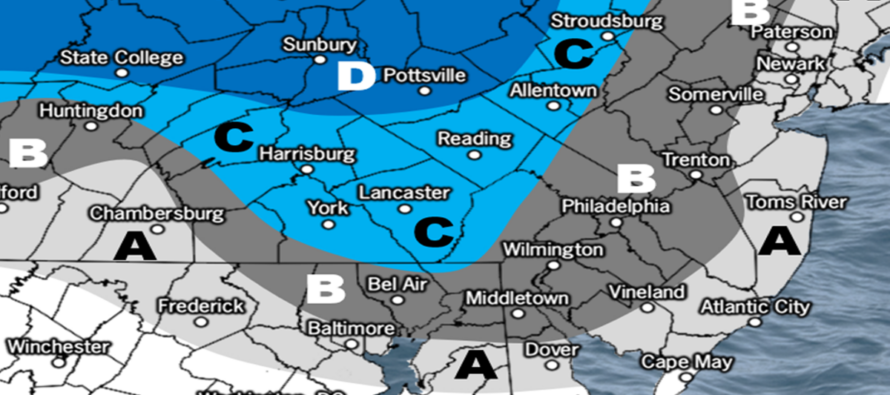
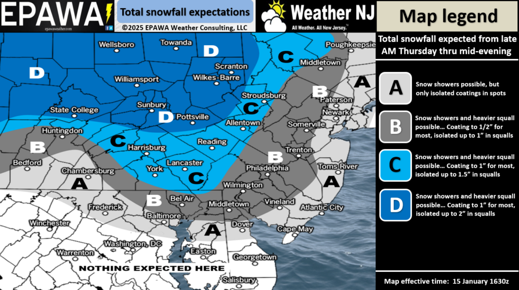
While many have been focusing on the upcoming pattern change back to one favorable for snow, it’s easy to become too far-sighted. In the immediate near sight, we have a clipper pushing in from the NW over the Great Lakes tomorrow (Thursday). Up until about yesterday, the Appalachian Mountains were gobbling up the clipper precipitation—allowing little-to-no precip to cross the apps and fall on the coastal plain. The upper level energy has evolved a little too strong for that and we now expect some light snow to fall E of the apps into EPA and NJ. Timing for EPA is more of a late-morning/afternoon thing while timing for NJ more of an afternoon/evening thing. So here’s a snow map for tomorrow afternoon/evening. Zone B likely just a coating to a half-inch and Zone A likely just some snow showers or maybe even just flurries with little-to-no accumulation.
Once the clipper is through, NJ will warm back up for the Friday into Sunday morning period. We’re looking at highs in the 30s/40s and lows in the 20s/30s. Within this period of moderation, rain showers are expected Saturday afternoon into Sunday morning. Some NNJ elevations could deal with mixed precip types at times but likely more of a ice situation than snow. Temps stay on the warm side until just after midnight (Sunday morning). Then temps will gradually fall throughout the day, eventually below freezing around sunset. At that point, our next snow signal is expected to push into NJ from the SW. This would come as an upper level disturbance with surface lifting riding the frontal boundary left by the rain system. It doesn’t look like a big snowstorm by any means. But likely plowable for wherever the jackpot axis lines up. This looks to come around 5-7pm Sunday and end just after midnight (Monday morning). A lot of Philadelphia Eagles interests are looking at this system as it means they could play in the snow should snow start closer to the 3pm game start. As you can see from the below model runs (12Z today), they are still all over the place. The CMC is anomalously warm (makes little sense with wall of Arctic air). The GFS is on the S side of the envelope (possible from cold suppression). The Euro between (where I am mentally on this):
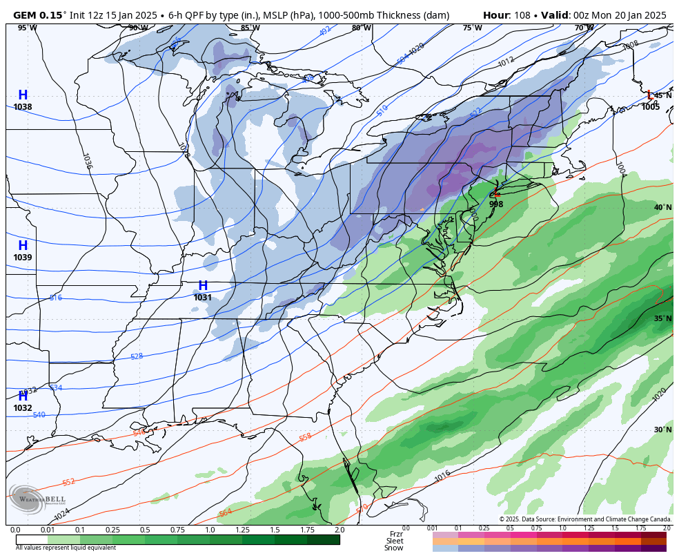
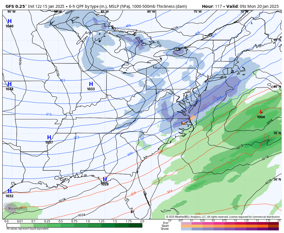
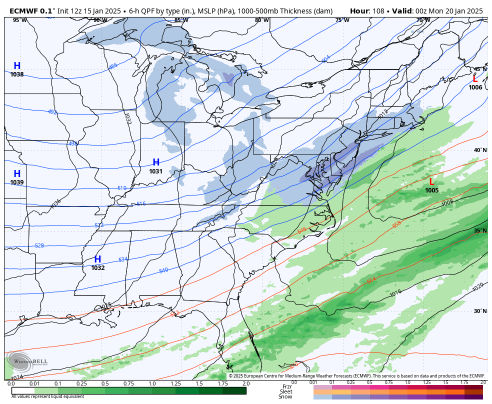
The first snow map and issued forecast for Sunday night into Monday (Jan 19-20) will be released on Friday. Even though we’re 4 days away at this point (Wednesday), there is too much disagreement and uncertainty to suggest a forecast…only enough evidence to state that the signal is still there and that we need to see more of a consensus before issuing any snow maps or forecasts. So I will be paying close attention over the next 36-48 hours of model guidance and upstream live observations to make the best call on Friday for Sunday PM-Monday AM’s potential snow.
Beyond the Jan 19-20 wave, we immediately fall back under cold Arctic air influence. There are then 3-5 more storm signals between January 23 and the end of the month. Models need to get details right on Jan 19-20 before putting any faith in specifics for these future signals. But the ensembles do confirm the existence of such signals and all falling in the more favorable pattern.
In English: It’s cold. Some light snow could fall tomorrow evening (Thursday) but mostly a nuisance/trace event of flurries, maybe snow showers at times. Friday, we warm up a little through Saturday and into early Sunday. Rain showers are possible Saturday into Sunday. Sunday afternoon, we fall back colder as snow approaches from the SW and falls Sunday PM into early Monday morning. The first snow map and detailed forecast for this will be released Friday. Still just tracking the signal for now. We then turn back to really cold Monday-forward with more (several) chances for snow through at least the end of January. Best I can do for now. Have a great rest of your Wednesday and please be safe! JC
Premium Services
KABOOM Club offers ad-free content, inside info forecast discussion, your questions answered, and early storm impact maps and video releases (ahead of the public). At two bucks per month, it’s an extremely feasible way to show additional support for Weather NJ. Think of it as a tip jar with perks. Available onFacebook or Patreon.
My Pocket Meteorologist (MPM), in partnership with EPAWA Weather Consulting, offers professional/commercial interests, whose businesses depend on outdoor weather conditions (snow plowing, landscaping, construction, etc.), with hyper-local text message alerts/forecasts and access to the MPM premium forum—the most comprehensive and technical forecast discussion available for PA and NJ.
Jonathan Carr (JC) is the founder and sole operator of Weather NJ, New Jersey’s largest independent weather reporting agency. Since 2010, Jonathan has provided weather safety discussion and forecasting services for New Jersey and surrounding areas through the web and social media. Originally branded as Severe NJ Weather (before 2014), Weather NJ is proud to bring you accurate and responsible forecast discussion ahead of high-stakes weather scenarios that impact this great garden state of ours. All Weather. All New Jersey.™ Be safe! JC


