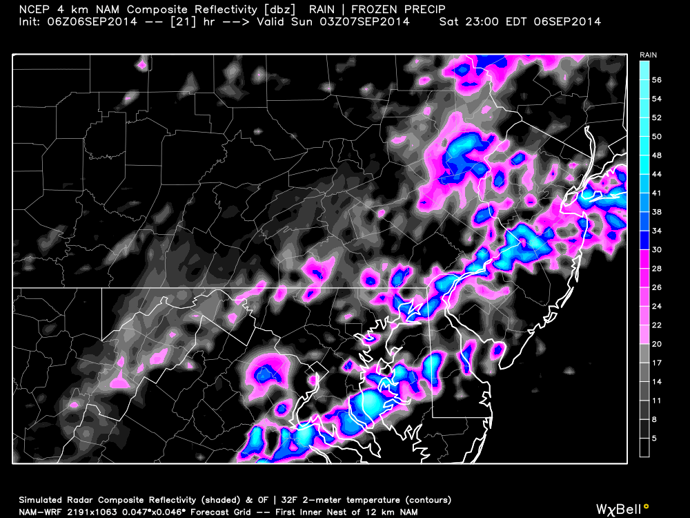
All ingredients are on the table for a stormy Saturday night. Instability will be high, wind shear should be sufficient, dew points will be jungle-like, and we have a trigger (cold front) rolling through from the NW. As far as timing goes, most of New Jersey should luck out until after sunset. Isolated pop-up showers and thunderstorms are possible as early as the afternoon but the main cluster of storms along the cold front should pass through between ~8PM and midnight. The storms should hit NWNJ first and SENJ last over a period of 3-4 hours. Here’s the high-res 4km NAM indicating precipitation intensity at 11PM:
Today should flirt, if not break, 90 degrees and feature relentless humidity. Any time you have dew points breaking 70, it’s a good indicator (not the only ingredient however) for thunderstorms. While wind shear is marginal, there will be plenty of instability to grow towering cumulonimbus clouds as we approach the afternoon-evening. The sun should have all day to diurnally heat the surface and destabilize the region. Check out the surface-based CAPE (Convective Available Potential Energy). That’s 3,000 j/kg (joules per kilogram) throughout most of the coverage area during the afternoon. Higher levels of the atmosphere feature plenty of instability as well (MLCAPE) which tells me light-show potential is high tonight:
In English: Expect a warm and humid day with isolated showers and thunderstorms in the afternoon followed by higher concentrations of storms after sunset. While most storms will be of strong nature, some could easily reach severe criteria so pay attention. I’m thinking lightning and tropical-like downpours will be the headline however. Everything should clear out by the early AM hours of tomorrow as a cold front moves through transforms the region from July to October. Be safe! JC
Jonathan Carr (JC) is the founder and sole operator of Weather NJ, New Jersey’s largest independent weather reporting agency. Since 2010, Jonathan has provided weather safety discussion and forecasting services for New Jersey and surrounding areas through the web and social media. Originally branded as Severe NJ Weather (before 2014), Weather NJ is proud to bring you accurate and responsible forecast discussion ahead of high-stakes weather scenarios that impact this great garden state of ours. All Weather. All New Jersey.™ Be safe! JC
