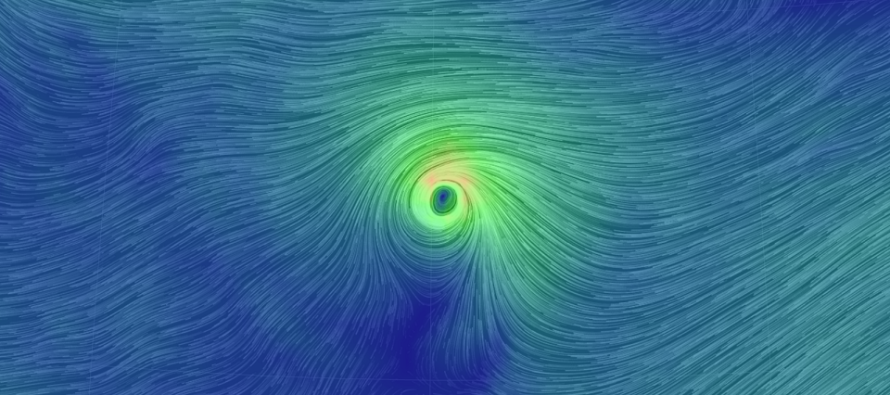
Sept 6: Florence Threat Increasing

Discussion: Florence, currently located at 25N 49.6W, has taken a substantial beating from the wind shear mentioned in last night’s article. There’s a chance it might even dip down to Tropical Storm status overnight into tomorrow. Unfortunately this is not a good thing. The general rule of thumb was that a stronger storm would want to curve N and E more while a weaker storm would want to drift W more. Since Florence has weakened, it will now drift more W.
Once Florence makes it through the remaining shear zone, it should begin strengthening again. I expect this to occur by tomorrow evening. Florence should then strengthen Saturday and Sunday before ultimately becoming a major category hurricane again by Monday evening. By that point it will likely be too late for the rescuing trough connection. With that said, I think this one is heading for the east coast.
There would still be some wiggle room for Florence to curve and stay out to sea. It would all depend on how the ridge rotates over-top of Florence’s N and NE sides. If the ridge is a little quicker (like the latest GFS modeled) then we could see Florence come close to the coast but stay far enough out to prevent the catastrophic scenario. NJ coastal impacts would be limited to anything from weaker fringe rain and wind to just super-elevated surf. If the ridge is slower and more stubborn (like the latest Euro modeled), then the landfall zone would be anywhere from OBX to the Jersey coast including most of E Delmarva.
The best data on the planet (Euro ensembles) threw out a tightly clustered members track into the east coast today which has further elevated my concerns. As I always say, we shouldn’t use model guidance as gospel…and meteorology > modelology. Live observations however are starting to support the worse than better scenario.
In English: I think Florence will miss the trough connection and head towards the east coast. I am still uncertain as to whether Florence will make direct landfall between OBX<->NJ, just graze the same area or stay slightly out to sea. Either way, you should all have a hurricane plan in place that you may have to start using on Saturday morning if the current status quo holds. NJ impacts, if the worse case scenario happens, would be between Thursday and hopefully only Saturday. This would mean major tidal flooding, flash-flooding rains and damaging winds. If the best case scenario happens then we would only see manageable wind and possibly just a few outer bands of rain if any. I’m going to try and put out a detailed video tomorrow. Have a great night and please be safe! JC
Jonathan Carr (JC) is the founder and sole operator of Weather NJ, New Jersey’s largest independent weather reporting agency. Since 2010, Jonathan has provided weather safety discussion and forecasting services for New Jersey and surrounding areas through the web and social media. Originally branded as Severe NJ Weather (before 2014), Weather NJ is proud to bring you accurate and responsible forecast discussion ahead of high-stakes weather scenarios that impact this great garden state of ours. All Weather. All New Jersey.™ Be safe! JC


