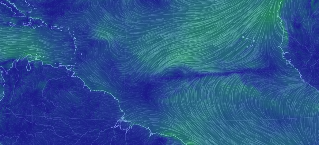
This is a great time to test out the new forecasting strategy as all eyes now turn to the formation of Matthew in the Atlantic Ocean.
If you’re looking for a “will this hit me on my favorite NJ shore spot next Friday?” answer then you should come back and visit once we’re withing a confident forecasting period about 36 hours before landfall, wherever that may happen. However if you are interested in tracking a potential major hurricane in the Atlantic Hurricane Basin from the first signs of organized lifting to wherever it ends up, then you’ve come to the right place.
There are some who will feel this is a “gun-shy” effort after the end result of Hermine’s forecast. I can assure you, there will be no shortage of advanced heads-up discussion about this storm. The only difference is that the public will be aware of not only the most probable scenario, but also the lesser probable wildcard outcomes. Essentially…what could go wrong with the forecast at each step. This strategy is shaped from almost 7 years of communication with the public regarding advanced warning of potentially dangerous weather conditions. With all of that said, let’s get to business…
Invest 97L is currently crossing the Atlantic Ocean from W Africa towards the southern Lesser Antilles. I must say, the track is typically S of the normal Cape Verde storm system. With that said, Matthew should form soon and enter the southern side of the E Caribbean Sea this Wed-Thurs. Given the easterly flow and steady pressure drops, this much is fairly confident.
The uncertainty increases tremendously once the system is inside the E Caribbean Sea. At that point the system is expected to curve somewhere to the N. Where Matthew tracks to will be determined by the upper-level pattern moving across North America from W to E. If there is a trough to his N then he would likely get lifted out to the NE and stay well out to sea. If there is a ridge over his head, then he could stay S and possibly hit the US somewhere between the Gulf and SE US. The bottom line is that we won’t know the exact upper level pattern until Matthew is there (inside E Caribbean). Models will likely sway back and forth with solutions because each run will have a different upper level setup moving across North America. Until that pattern is within the 96 hour window of model guidance, it’s laughable to assume anything from a single model run whether showing catastrophic or out-to-sea outcomes. Try not to get juked basically.
Therefore, a forecast track with any level of confidence ends just inside the E Caribbean Sea. Beyond that will have to be determined as the system approaches that location and the upper-level pattern is modeled with more confidence.
In English: So for now, we track and watch Invest 97L become Matthew as it heads towards the Lesser Antilles. Once we’re there, I’ll be able to determine the most and least likely outcomes based on live observations of the atmosphere compared against model guidance. At this time no threat is forecasted for New Jersey…not even for the US yet. This should be a powerful storm though, wherever it ends up. It wouldn’t be to our latitude until later next week were it to come N. Have a great rest of your Sunday and please be safe! JC
Jonathan Carr (JC) is the founder and sole operator of Weather NJ, New Jersey’s largest independent weather reporting agency. Since 2010, Jonathan has provided weather safety discussion and forecasting services for New Jersey and surrounding areas through the web and social media. Originally branded as Severe NJ Weather (before 2014), Weather NJ is proud to bring you accurate and responsible forecast discussion ahead of high-stakes weather scenarios that impact this great garden state of ours. All Weather. All New Jersey.™ Be safe! JC
