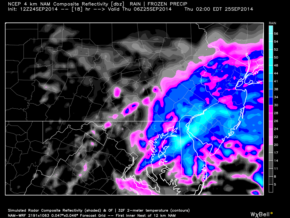
Current observations indicate the center of the storm to be just south of OBX moving N/NE. A large area of precipitation to the north of this center is being driven inland off the ocean. The northern edge of precipitation has made it into southern parts of Delmarva and will continue to expand into New Jersey throughout the remainder of today. By early evening, light rain should be into SNJ. By midnight, most of New Jersey should be under heavy rainfall which should last well into tomorrow morning. Expect between 1 and 3 inches of rain with local amounts possibly higher when all is said and done. Much needed! Highest sustained winds will occur along the ocean at 15-25mph with gusts to 35mph. As you head west/inland away from the coast, winds will be less intense. Wind direction will be E/NE making for horrendous marine conditions along the shore and inside the Delaware Bay. Here’s the high-resolution 4km 12Z NAM showing heavy precipitation at 2AM across parts of EPA and the entire state of New Jersey:
With any luck, we’ll clear out by tomorrow afternoon. If not, then definitely by evening. Again, the most intense period of rain and wind is modeled between midnight tonight and noon tomorrow. Rush hour tomorrow morning should be a disaster with flash flooding possible in nearly every New Jersey county. Stay dry and please be safe! JC
Jonathan Carr (JC) is the founder and sole operator of Weather NJ, New Jersey’s largest independent weather reporting agency. Since 2010, Jonathan has provided weather safety discussion and forecasting services for New Jersey and surrounding areas through the web and social media. Originally branded as Severe NJ Weather (before 2014), Weather NJ is proud to bring you accurate and responsible forecast discussion ahead of high-stakes weather scenarios that impact this great garden state of ours. All Weather. All New Jersey.™ Be safe! JC
