Sept 23: Coastal Storm Alert!

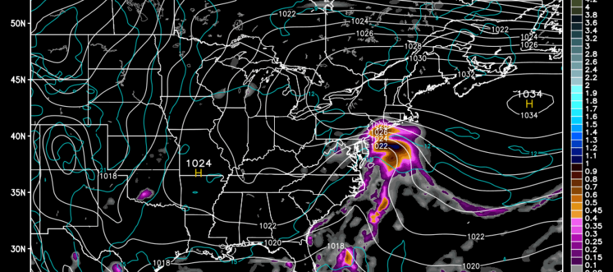
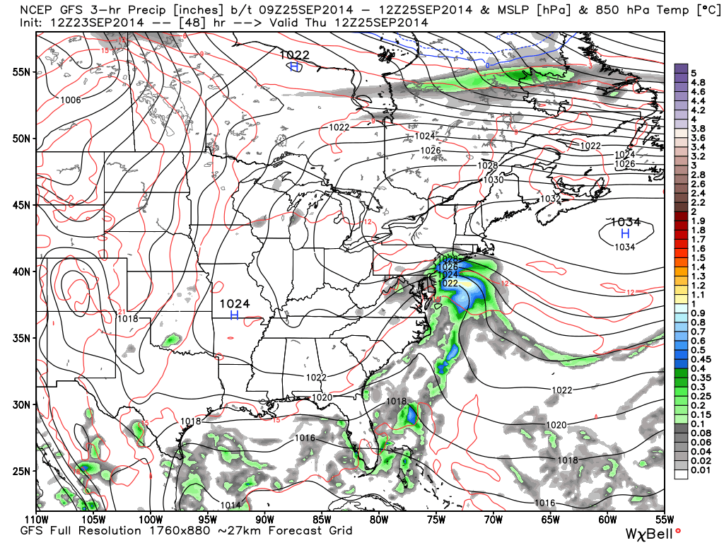
Short-range model guidance has come into agreement that a low pressure system will impact the east coast on Thursday. Moderate rain and gusty winds are expected. As far as exact timing goes, precipitation could start as early as Wednesday evening and last through Thursday evening. I’ll be able to narrow that window as we approach closer. .5 to 1 inch of rain is possible across the region when all is said and done. Onshore winds should be pretty “run of the mill” for a NJ coastal low pressure system…sustained at 10-20mph with gusts to 30. Minor beach erosion and tidal flooding is possible. Here’s the GFS for Thursday morning at 8AM showing pressure and precipitation at the 850mb level:
Originally, this week was supposed to be a straight stretch of beautiful weather. Not to worry because today, tomorrow, and Friday will still be beautiful. This Thursday disturbance only popped up on recent guidance with the following synoptic reasoning: Two high pressure systems were originally modeled to cross the eastern us from west to east, one to the north of NJ and one to the south. High pressure systems have anti-cyclonic flow meaning they rotate clockwise in the northern hemisphere. The first high pressure center passes to our north creating a southerly flow behind it. The second high pressure center was supposed to kick that southerly flow out to sea and keep the flow westerly. That second high pressure center is now modeled slower (biggest changing factor). It now allows enough time for the coastal low pressure center (cyclonic flow – counter-clockwise in northern hemisphere) to tuck in behind it and impact New Jersey. How much storm impact NJ sees will be a direct reflection of that second high pressure center’s timing. If it’s slower, we see more of the coastal storm. If it’s faster, we see less. I’ll be tracking and updating as we approach. Be safe! JC
Jonathan Carr (JC) is the founder and sole operator of Weather NJ, New Jersey’s largest independent weather reporting agency. Since 2010, Jonathan has provided weather safety discussion and forecasting services for New Jersey and surrounding areas through the web and social media. Originally branded as Severe NJ Weather (before 2014), Weather NJ is proud to bring you accurate and responsible forecast discussion ahead of high-stakes weather scenarios that impact this great garden state of ours. All Weather. All New Jersey.™ Be safe! JC


