Sept 22: East Coast Concerns Remain

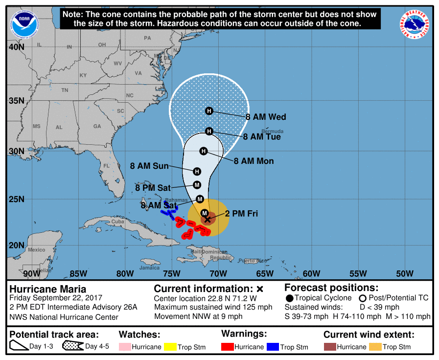
Discussion: There is no doubt a westward trend of Maria’s expected track on most model guidance today, especially when comparing to last night and yesterday’s model suites. Let’s talk present before talking future. Here are the current vitals from the National Hurricane Center’s latest update:

Notice the bend to the west towards the day 4-5 cone of uncertainty? Notice how close the west side of the cone of uncertainty is to OBX?
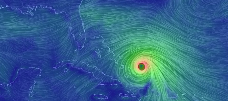
In the immediate period, Maria is expected to head northward through the Bermuda Triangle. The upper-level low over the Gulf of Mexico and the weak ridge to the east of Maria should hold Maria in the general northward direction until about the 32N latitude (towards the ridge weakness created by Jose’s fizzling extra-tropical remnants). Once the ridge beats Jose into fizzilation, there are no apparent/obvious steering currents to take Maria out to sea…YET…only the easterly/blocking flow beneath the ridge. Therefore, a period of westward drift is expected in Maria’s track (N/NW or even NW movement). This presents the greatest risk to the OBX region as Maria moves northward towards the 35N latitude Monday into Tuesday. Until the upper-level trough approaches from the west and sweeps Maria to the E/NE and out to sea, the N/NW or NW movement could continue towards/through OBX and possibly towards Delmarva/NJ. Ultimately I think Maria will miss New Jersey with direct impacts. Secondary impacts are very possible, especially if OBX were to see primary impacts. Last night I was 80/20 on an out to sea miss/east coast hit. Today, after seeing the most recent trends, I’m back to 70/30.
In English: Maria could come uncomfortably close to OBX between Tuesday-Wednesday. I’m still not sold on a 100% out to sea solution for OBX. If Maria hits OBX then secondary impacts to Delmarva and New Jersey could be stronger than expected Tuesday night through Thursday morning (heavy rain, tropical storm winds and moderate coastal flooding). I give this only a 20% chance of happening at this time. If Maria just misses OBX out to sea then New Jersey would likely be held to just rough surf, minor coastal flooding, manageable winds and clearer/drier skies Tuesday night through Thursday morning. I give this an 80% chance of happening and therefore am leaning this way. My next update will be tomorrow afternoon. Until then, we’ll be discussing run-by-run model analysis with much more technical detail in our Premium Forum. Have a great Friday night and please be safe! JC
Jonathan Carr (JC) is the founder and sole operator of Weather NJ, New Jersey’s largest independent weather reporting agency. Since 2010, Jonathan has provided weather safety discussion and forecasting services for New Jersey and surrounding areas through the web and social media. Originally branded as Severe NJ Weather (before 2014), Weather NJ is proud to bring you accurate and responsible forecast discussion ahead of high-stakes weather scenarios that impact this great garden state of ours. All Weather. All New Jersey.™ Be safe! JC


