Sept 18: Monitoring Karl

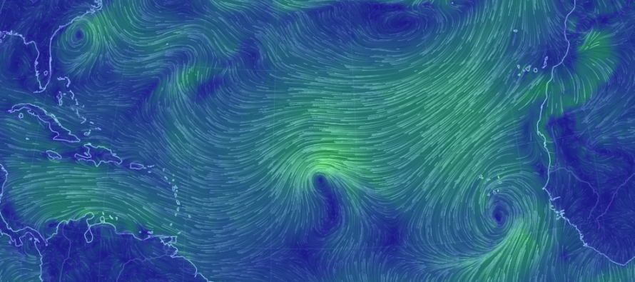
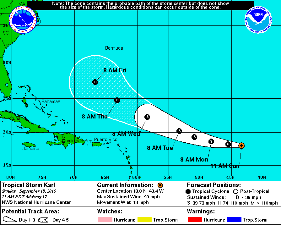
Tropical Storm Karl formed last week just S of the Cape Verde region off W Africa. He is now steaming towards the Bermuda Triangle and is expected to reach hurricane strength. There is much uncertainty as to what Karl will do once near the Bermuda Triangle so let’s break it down…
High pressure situated between Bermuda and the Azores will allow Karl to continue tracking to the W/NW. This trajectory should be NE of the Lesser Antilles/NE Caribbean but still towards the US East Coast. The certainty of this track is pretty high. It’s once Karl reaches the Bermuda Triangle that the uncertainty grows. Here’s is the latest track and storm info from the National Hurricane Center…
It will all come down to upper-level energy departing the US and Canadian Atlantic coast. If an upper level trough times perfectly with Karl, then it will lift Karl out to the NE before ever reaching land. This would result in rip currents and increased swell along the entire US East Coast but with no destructive winds or heavy rainfall.
If the upper-level trough departs into the N Atlantic Ocean without connecting with Karl, then he could take a dangerous track into the US East Coast and slip right into and under an upper-level ridge. This could spell problems for a decent chunk of the US East Coast but it is far too early to speculate exactly where.
So that’s what it comes down to…away and out to sea with the upper-level trough or into the US under a ridge. I’ll be watching this daily and will update accordingly.
In English: There’s a tropical storm out there in the Atlantic Ocean named Karl that requires monitoring. He should become a hurricane in a few days and play a game of chicken with the US East Coast. I’m still monitoring the upper-level pattern to see whether Karl will chicken out to sea or possibly create problems for the US East Coast. Should the latter occur, such impacts wouldn’t be until after this weekend, likely mid-next week. Hopefully the former happens. Be safe! JC
Jonathan Carr (JC) is the founder and sole operator of Weather NJ, New Jersey’s largest independent weather reporting agency. Since 2010, Jonathan has provided weather safety discussion and forecasting services for New Jersey and surrounding areas through the web and social media. Originally branded as Severe NJ Weather (before 2014), Weather NJ is proud to bring you accurate and responsible forecast discussion ahead of high-stakes weather scenarios that impact this great garden state of ours. All Weather. All New Jersey.™ Be safe! JC


