Sept 10: Rainfall Update

“I don’t think the heavy stuff’s gonna come down for quite awhile.” – Carl Spackler, Caddyshack (1980)
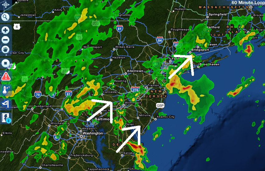
The current radar shows isolated-to-scattered showers and thunderstorms moving through our region. An area of heavy rainfall associated with a thunderstorm moved through Ocean and Monmouth Counties this morning. The general flow of precipitation is currently from SW to NE but that should change as the low approaches and passes New Jersey:
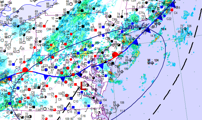
The surface low has formed over Virginia along the cold front, as expected, and will begin enhancing the the rainfall—filling it in on radar between this afternoon and evening:
So…isolated-to-scattered showers and thunderstorms through this afternoon followed by scattered-to-widespread heavy rainfall with embedded thunderstorms late afternoon through evening. The good news is that the expected additional weekend rainfall might fall overnight from Saturday night into Sunday morning sparing more daylight hours than overnight hours for outdoor activities. When we’re all said and done, we’re still looking at 2-3 inches of rainfall across the entire state. I’ll have the weekend outlook out around 7PM. Stay dry and be safe! JC
Image used from Caddyshack (1980), retrieved from Google Images under the “Labeled for reuse” usage rights provision.
Jonathan Carr (JC) is the founder and sole operator of Weather NJ, New Jersey’s largest independent weather reporting agency. Since 2010, Jonathan has provided weather safety discussion and forecasting services for New Jersey and surrounding areas through the web and social media. Originally branded as Severe NJ Weather (before 2014), Weather NJ is proud to bring you accurate and responsible forecast discussion ahead of high-stakes weather scenarios that impact this great garden state of ours. All Weather. All New Jersey.™ Be safe! JC


