Sept 10: Rain and Storms Possible Tomorrow

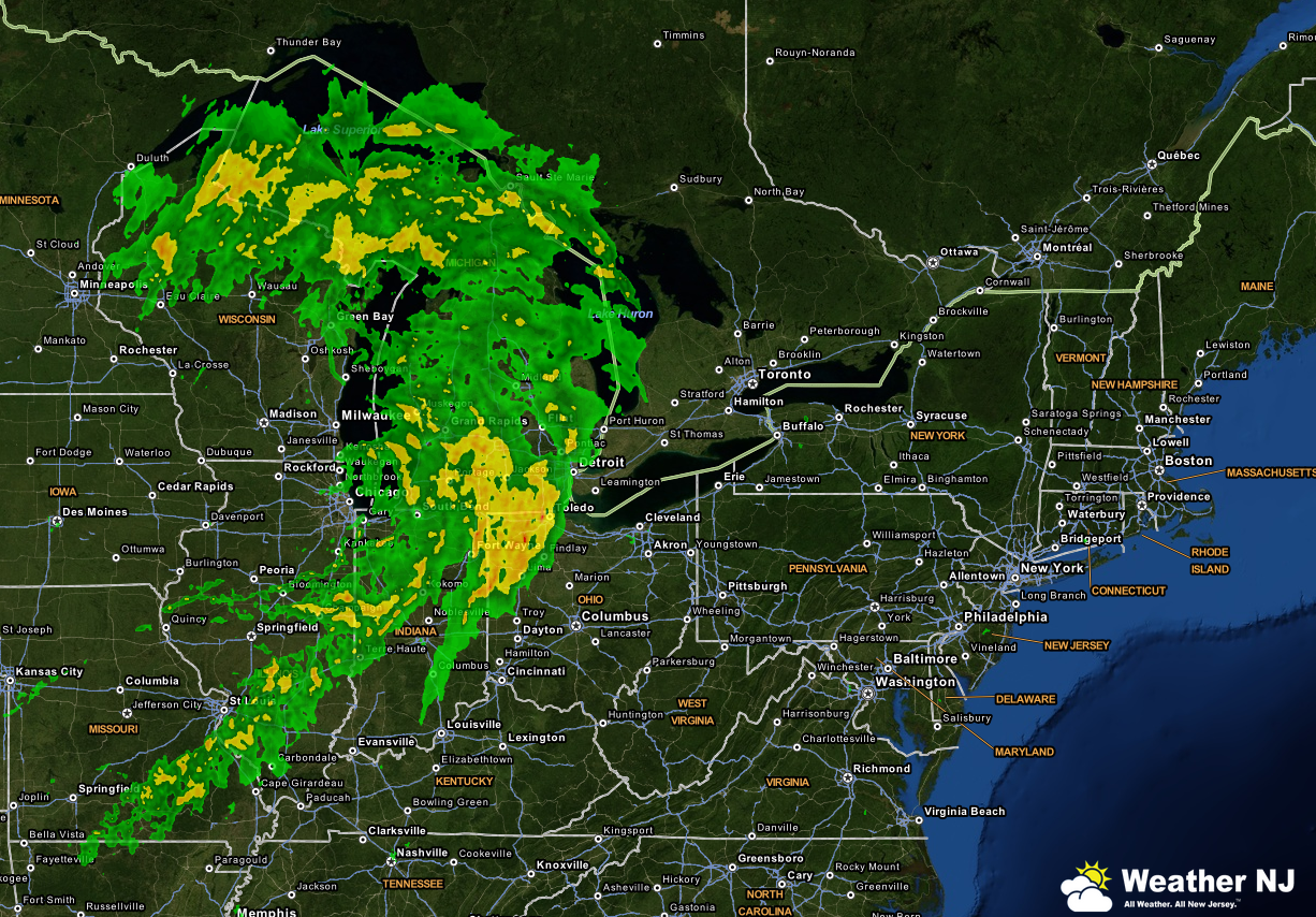
A low pressure system will be moving from the Great Lakes region into E. Canada between now and tomorrow evening. Attached to the southern side of this system will be a frontal passage with showers and thunderstorms ahead of it. This is impacting areas further to our west today and will impact the east coast tomorrow afternoon-evening with gusty winds and possible flash flooding from heavy rainfall. Here’s a radar image showing the current location of the system with the center of circulation about to enter Lake Michigan:
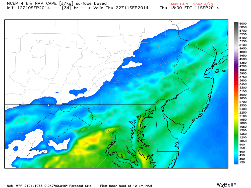
Let’s talk about instability first. Most storms this summer have featured high levels of instability, both at the surface and higher levels. This typically results in towering cumulonimbus clouds with frequent lightning. Tomorrow will be different. CAPE (Convective Available Potential Energy) levels will be hovering around 1200 J/Kg (Joules per Kilogram). That’s considered marginal at best for thunderstorm development. With that being said, I expect thunderstorm cloud tops to be lower with less lightning. Here’s the high-res NAM showing surface-based CAPE values right before rain/storm time in the late-evening:
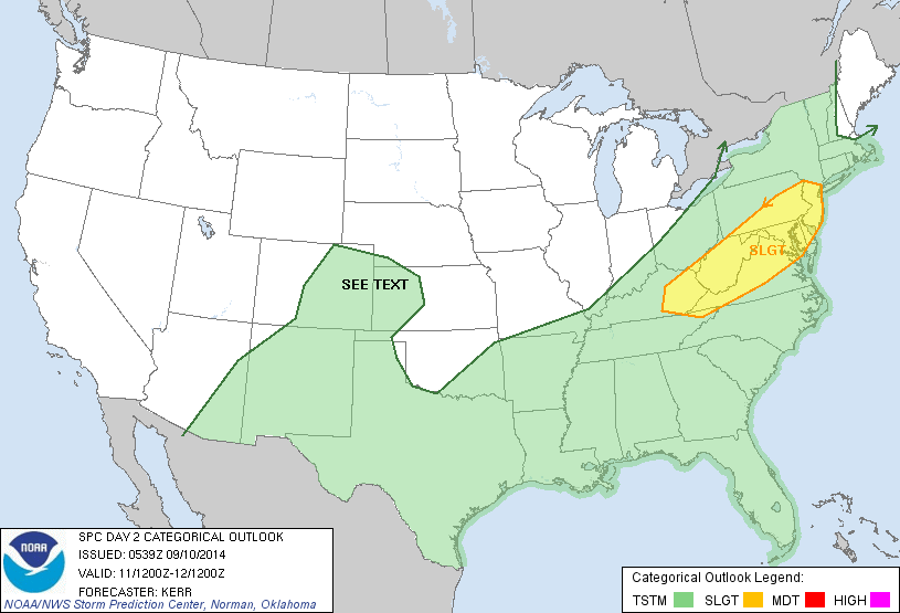
Now lets talk wind. Bulk effective wind shear from the surface up to the 500mb level (18k feet) will be varying in the 30-40kt range. If those winds are enhanced by convective downdrafting and brought to the surface, it’s enough to trigger severe thunderstorm warnings. 58mph is the criteria for that and I have to allow for isolated instances of such. This is probably why the National Weather Service Storm Prediction Center is going with an elevated risk for severe weather (as seen below):
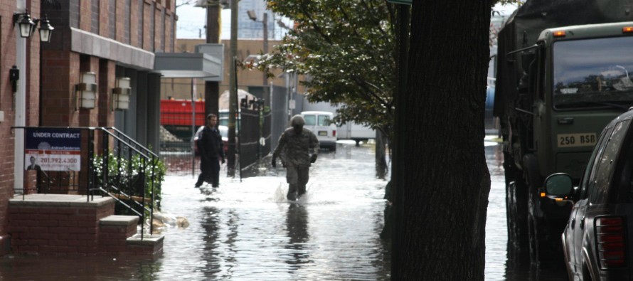
In English: First, watch out for tidal flooding near the ocean and back bays today. The coastal storm is pulling away but onshore flow timed with high tide can still push water through the drains and into the streets. Expect it to be warmer and muggier tomorrow with light southwest flow. At some point tomorrow afternoon-evening (will narrow as we approach), showers and storms should move through the state from northwest to southeast over the period of a few hours. Expect gusty winds, heavy downpours (flash flooding) and infrequent lightning (rolling thunder). Isolated cases of severe winds are possible (greater then 58mph) so batten down the hatches. I’ll be tracking. Be safe! JC
Jonathan Carr (JC) is the founder and sole operator of Weather NJ, New Jersey’s largest independent weather reporting agency. Since 2010, Jonathan has provided weather safety discussion and forecasting services for New Jersey and surrounding areas through the web and social media. Originally branded as Severe NJ Weather (before 2014), Weather NJ is proud to bring you accurate and responsible forecast discussion ahead of high-stakes weather scenarios that impact this great garden state of ours. All Weather. All New Jersey.™ Be safe! JC


