Sep 1: Hit or Miss Rain for Labor Day

First, I’d like to wish the entire Weather NJ fanbase a Happy Labor Day. Our country would never be where it is without its workers since its founding. One day of weather remains in this traditional summer weekend and it looks to feature hit-or-miss showers and thunderstorms. They will not be widespread like last night in CNJ/SNJ. Instead they should be more of a scattered nature.
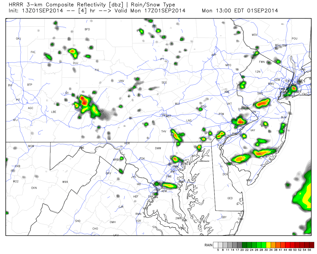
Consider today’s expected widespread rainfall robbed from last night. There’s still a lot of moisture int he atmosphere however. The radar is currently clear as diurnal heating destabilizes and builds rain/storm clouds. Therefore, lets go right to the ultra short-range HRRR model showing scattered showers and storms as early as 1PM:

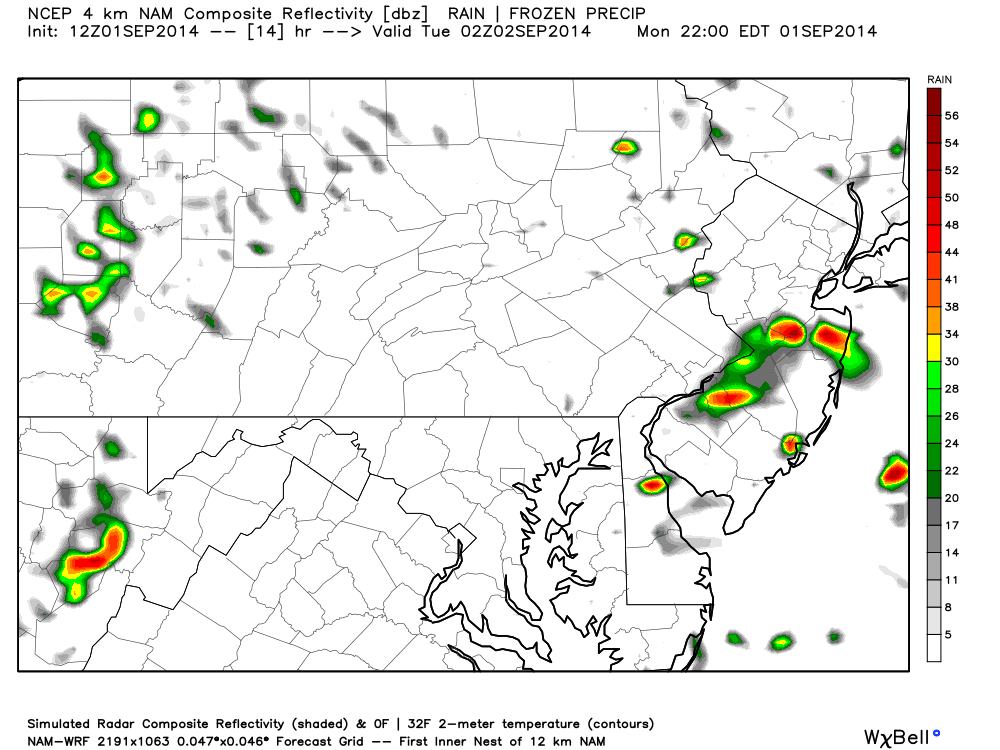
The high-res 4KM NAM holds off scattered showers and storms until later this evening:
In English: Some of you will experience tropical-like downpours while others will be missed. Regardless, everyone will deal with heat, humidity and a mixed bag of sun and clouds today in-between possible scattered showers and storms. Light SW flow will persist. Meteorological summer has ended and now meteorological autumn begins despite a warm week expected. I’ll have an outlook out tonight that will take us into the upcoming weekend. Be safe and again, have a great holiday! JC
Model images reproduced with permission from WeatherBell Analytics.
Jonathan Carr (JC) is the founder and sole operator of Weather NJ, New Jersey’s largest independent weather reporting agency. Since 2010, Jonathan has provided weather safety discussion and forecasting services for New Jersey and surrounding areas through the web and social media. Originally branded as Severe NJ Weather (before 2014), Weather NJ is proud to bring you accurate and responsible forecast discussion ahead of high-stakes weather scenarios that impact this great garden state of ours. All Weather. All New Jersey.™ Be safe! JC


