Pleasant Start Unsettled Finish

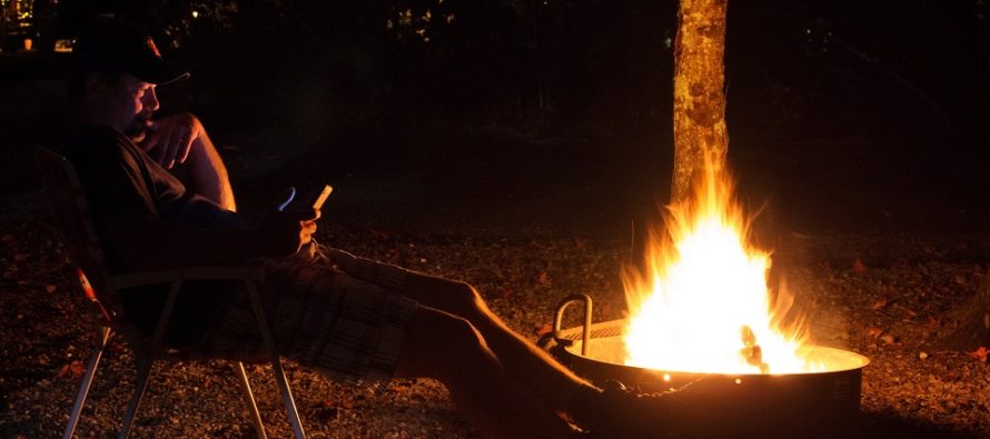
Discussion: We’re stuck at the N top of a steep east coast ridge Friday and Saturday before giving way to a phasing trough in Canada with lower heights for Sunday night into Wednesday. Higher heights and NW upper-level flow return Wednesday and look to last into the weekend. At the lower levels we have high pressure overhead of NJ Friday and Saturday making both days beautiful for late-summer standards. Re: the above image, tonight (Friday) and tomorrow night (Saturday) are the days you’ll want to sit by a fire. Friday night likely the coolest night of the weekend. Sunday looks like a day of transition where cloudy skies will likely move in by mid-to-late morning and dominate daytime hours with rain chances increasing throughout the day. Isolated stuff late-morning through afternoon then steadier stuff after sundown. The high will then depart offshore by Sunday night bringing return flow back in from the S. However, another cold front will quickly approach from the W and generate an area of convergence over NJ in the warm sector for Sunday night into Tuesday. For these reasons, Monday and Tuesday look very unsettled (warm, muggy, rainy, maybe stormy). Once the cold front (attached to a lakes-tracking low) pushes through, I’m then seeing a nice little stretch of clear and dry weather Wednesday into next weekend. As of right now, most data keeps us under NW upper flow and higher heights straight through Sunday. The tropics remain extremely quiet for interests in the western Northern Atlantic Ocean even now in peak hurricane season.
Friday (Sept 9) high temperatures have a few more degrees to rise before maxing around 3-4pm. Areas away from the ocean have the best chance to reach just into the lower-80s. Coastal regions should remain in the mid-to-upper 70s. Humidity is low for most (a little higher near the ocean). Winds are light out of the N/NE. These conditions should hold overnight as low temperatures head down to the 50-60 range from elevations to coasts. Radiational cooling might take some areas even cooler (NWNJ elevations + SNJ Pine Barrens). At some point higher humidity will start working into at least SNJ by sunrise Saturday morning.
Saturday (Sept 10) high temperatures should reach into the 80s for most areas, likely mid-80s or slightly higher for interior CNJ/SNJ. With warmer moist air advancing off the ocean into cooler mainland air, fog is possible Saturday morning (mainly SE of NJTP) but should bake off rather quickly once the sun is up. After that, skies should be mostly sunny for the rest of the day but with gradually increasing humidity. Light winds should transition from SE to SW throughout the day. Overnight lows should fall into the 60-70 range from elevations to coasts.
Sunday (Sept 11) high temperatures should reach near-80 for most with a humid feel. Skies should be mostly cloudy with isolated showers around during the day and scattered-to-widespread rainfall likely by evening. Winds should be light out of the S/SW. Overnight lows should fall into the mid-60s for most as rainfall pushes into Monday.
This weekend in a sentence: Beautiful late-summer conditions Friday and Saturday before ending warm and gloomy Sunday.
An early look at next week indicates an unsettled and humid Monday-Tuesday followed by clear and pleasant conditions Wednesday into next weekend. Everyone have a great weekend and please be safe! JC
Premium Services
KABOOM Club offers inside info forecast discussion, your questions answered, and early storm impact maps (ahead of the public). At a buck per month, it’s an extremely feasible way to show support.
My Pocket Meteorologist (MPM), in partnership with EPAWA Weather Consulting, offers professional/commercial interests, whose businesses depend on outdoor weather conditions (snow plowing, landscaping, construction, etc.), with hyper-local text message alerts/forecasts and access to the MPM premium forum—the most comprehensive and technical forecast discussion available for PA and NJ.
Jonathan Carr (JC) is the founder and sole operator of Weather NJ, New Jersey’s largest independent weather reporting agency. Since 2010, Jonathan has provided weather safety discussion and forecasting services for New Jersey and surrounding areas through the web and social media. Originally branded as Severe NJ Weather (before 2014), Weather NJ is proud to bring you accurate and responsible forecast discussion ahead of high-stakes weather scenarios that impact this great garden state of ours. All Weather. All New Jersey.™ Be safe! JC


