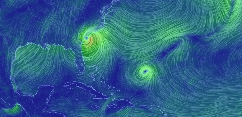
A very ominous sight as Matthew’s eye passes over coastal South Carolina. The definition of landfall is when the center of the eye moves over any part of land. Whether or not that is achieved, coastal South Carolina and parts of coastal North Carolina are in for continued impact over the next 12-24 hours. Matthew has weakened to a category 1 hurricane so the destructive wind potential is lessening. Storm tide/surge and heavy rainfall remain the biggest threat from Matthew.
We can’t ignore the model guidance that still suggests a more direct E heading after Matthew turns and misses just south of OBX…rather than the loop idea. With that said, I think we could see a little more convergence ahead of the cold front. Obviously we would see less enhancement if Matthew does in fact go for the loop, making the turn to the E even further S of OBX. This reminds me of winter scenarios where the precipitation shield over-performs from a southern slider (a low that tracks well out to sea before bringing snow to our latitudes).
However, given the speed of the cold front, it should create two very distinct rainy environments. For those subject to the frontal precipitation only (which includes EPA and most of NJ), it’s just going to be a scattered showers kind of day. For those subject to the additional convergence (which includes Delmarva and possibly SENJ IMO), run-of-mill coastal low conditions would be possible. This would mean a few inches of rainfall, 15-25mph sustained NE or E/NE winds with gusts to 35mph felt moreso along the SENJ coast, and minor coastal flooding. Based on the latest guidance and observations, I currently put the division between those two environments just SE of the I-95 corridor. As far as timing, I expect precipitation to move into SNJ over the next few hours. The rainiest and windiest conditions, again SE of I-95, should occur this evening and overnight with everything clearing to the E by late tomorrow morning. Areas subject to just scattered frontal showers , again NW of I-95, are subject to a shorter duration event with less precipitation. Most regions should clear earlier than late tomorrow morning. It would be points E to clear last.
This could time poorly with public perception and falsely generate worry… “Matthew is coming here?!” At least we know that the center of circulation will be just S/SE of OBX and is not expected to take a drastic turn N towards us.
In English: Rain should continue to spread into NJ from the S and W over the next few hours. The S rain is from Matthew’s northern bands. The W rain are scattered showers ahead of a cold front. Rain should then spread into the entire state by tonight. Those NW of the 1-95 corridor/NJTP will see a shorter duration rain event with less precipitation. Those to the SE of the I-95 corridor/NJTP are subject to enhanced rainfall, gusty onshore winds and minor coastal flooding…obviously and especially the SENJ coast. Everything should clear by tomorrow morning with SENJ likely clearing last by late morning. Again, that makes this evening, overnight hours and early AM tomorrow hours the rainiest and windiest for SENJ. The important thing you need to know is that Matthew will not hit NJ…that we will only be experienceing northern-fringe impacts from him fist bumping the cold front—which in the worst case scenario resembles a short-duration coastal storm/low for us. Not a nor’easter! Please be safe! JC
Jonathan Carr (JC) is the founder and sole operator of Weather NJ, New Jersey’s largest independent weather reporting agency. Since 2010, Jonathan has provided weather safety discussion and forecasting services for New Jersey and surrounding areas through the web and social media. Originally branded as Severe NJ Weather (before 2014), Weather NJ is proud to bring you accurate and responsible forecast discussion ahead of high-stakes weather scenarios that impact this great garden state of ours. All Weather. All New Jersey.™ Be safe! JC
