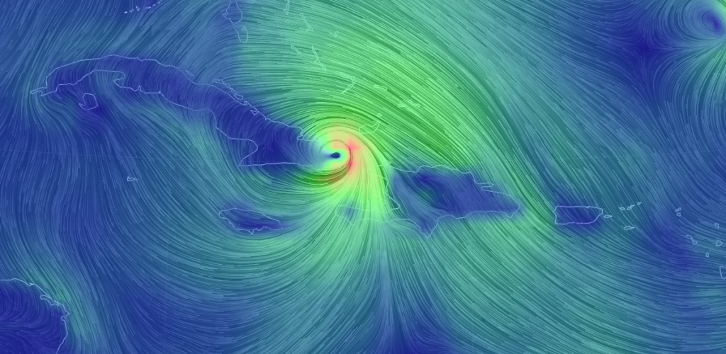
Models are beginning to converge on a more confident solution for Major Hurricane Matthew…
The trends that have taken shape overnight and through today are as follows:
1) Matthew passed a little E of Jamaica than expected however made direct landfall on the W tip of Haiti. He is currently making landfall on the E tip of Cuba and will now head into the Bahamas. Mathew is still a major hurricane and could actually re-strengthen all intensity lost from the elevations surrounding each side of the windward passage through the Greater Antilles (Cuba and Hispaniola elevations).
2) Matthew is being modeled closer to the SE US coast. Anything between a direct landfall and a passage about 100 miles off the entire SE US coast is still possible. Either way, the entire SE US coast from Florida to OBX should expect possible hurricane-force conditions between Friday morning and Saturday night. Many models are showing hits between E FL and SC/NC.
3) Matthew is being modeled further away from the New Jersey coast (to the SE) once N of the 35N latitude. He might even jet E after Cape Hatteras (OBX). There is a lot of model agreement converging on this idea. With that said, New Jersey and surrounding Mid-Atlantic US areas would be spared from the worst of Matthew’s inner core of higher winds and dangerous storm surge. Secondary impacts however would be possible in the form of minor-to-moderate NE winds, minor-to-moderate coastal flooding during a few high tides and possible heavy rainfall due to Matthew interacting with the approaching upper-level trough (cold front at the surface). This would all go down between Saturday night and Sunday morning, possibly into Sunday evening. At the end of the day, we wouldn’t be looking at anything too serious. The following video takes a deeper dive into these concepts:
In English: We’ve seen some more positive trends for New Jersey overnight and today. While the current consensus misses New Jersey with the core energy and wind of Matthew to the SE, we could still be on the hook for some widespread rainfall in the Saturday PM-Sunday period as the cold front moves through. Winds and coastal flooding could still range from minor-to-moderate at times but would be far from a historic or major impact. So still pay attention but take a deep breath because it’s looking better for New Jersey re: Matthew. To those in the windward passage area of the Greater Antilles, the Bahamas and whoever gets hit along the SE US coast…you are in our thoughts. Stay strong and be safe! JC
Jonathan Carr (JC) is the founder and sole operator of Weather NJ, New Jersey’s largest independent weather reporting agency. Since 2010, Jonathan has provided weather safety discussion and forecasting services for New Jersey and surrounding areas through the web and social media. Originally branded as Severe NJ Weather (before 2014), Weather NJ is proud to bring you accurate and responsible forecast discussion ahead of high-stakes weather scenarios that impact this great garden state of ours. All Weather. All New Jersey.™ Be safe! JC
