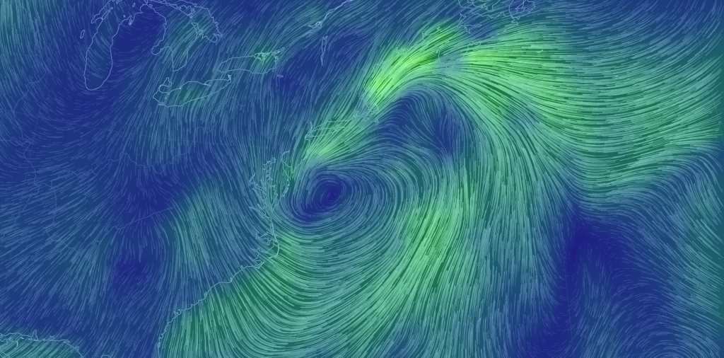
The coastal storm is now well formed about 175 miles east of the lower Delmarva Peninsula. Rain and wind will continue to wrap around it’s cyclonic flow well into tomorrow morning. Winds have been gusting to 25/30mph along the immediate coast and rainfall amounts have been measured in inches. CNJ and SNJ have seen the majority so far but NNJ should be next up later this evening/overnight. Rain could begin tapering off as early as late tomorrow morning but more confidently by late afternoon/early evening. Lets look at some short-range high-resolution model guidance (precipitation intensity on the 4km NAM).
First lets look at the immedate future (afternoon). This is pretty accurate showing pockets of heavy precipitation moving onshore into CNJ and SNJ.
Next, lets look at the early AM hours of tomorrow. As you can see the storm has moved further away to the NE but outer rain bands are affecting almost the entire state, including NNJ.
Finally, lets look at 5PM tomorrow afternoon. At this point the last few rain showers are tapering off completely but northerly winds remain stiff. They will likely not subside until Friday afternoon/evening but they should help dry things out. Don’t be surprised to still see 25/30mph gusts. The system then continues to pull away and become a nor’easter for extreme northeast New England. For NJ today and tomorrow, it’s just a coastal low or coastal storm (your preference).
In English summary: Expect rain and wind through tomorrow afternoon. Rain might end a little earlier tomorrow but winds will stick around through Friday. This is not a bad storm by any means. Only minor coastal flooding and beach erosion are expected in addition to a few inches of rain and 25-30mph winds. As I said last week…a run of the mill October coastal storm. Friday evening, all of Saturday, and well into next week looks sunny and dry with seasonably average temperatures. Be safe! JC
Jonathan Carr (JC) is the founder and sole operator of Weather NJ, New Jersey’s largest independent weather reporting agency. Since 2010, Jonathan has provided weather safety discussion and forecasting services for New Jersey and surrounding areas through the web and social media. Originally branded as Severe NJ Weather (before 2014), Weather NJ is proud to bring you accurate and responsible forecast discussion ahead of high-stakes weather scenarios that impact this great garden state of ours. All Weather. All New Jersey.™ Be safe! JC
