Nov 19: Is this the winter 1976-77 replay?
WESTERN NY MEGA LAKE EFFECT SNOWFALL
Weather people, and for that matter most people when facing situations from day to day, fall back to comparing similar events in the past in order to anticipate outcomes. It happened like this once before so it is logical to assume that given similar circumstances it will happen again the same way. Such is the life of a meteorologist in constant search for the answer to the winter long range forecast because..to be honest…they want it cold and snowy! It is in our hearts we just love it to be a white Christmas for 3 months!
Understandably however most sane people don’t and I don’t either since I’m not as resistant to cold like I use to be. But forecasters have been grasping for analogs and given the utterly ridiculous snowfalls that have been occurring in Western NY, I thought this would be a good time to take a look at a couple of stand out winters.If you want to read about the meteorology behind that winter this is a good starting point.
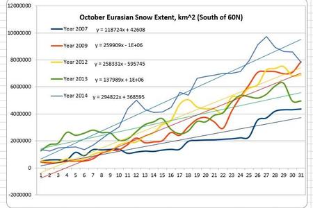
The first comparison that has been thrown around in weather geek land is the winter of 1976-1977 and the reason for that is the October Eurasia snow cover index that is all the rage right now in the long range community. It is exciting because apparently there is a correlation between how fast the snow cover grows in Siberia/NE Europe during October and NE winters. When the index slope is advancing as shown on the chart below then the winters are usually cold and snowy. It apparently works about 90 percent of the time.
This year’s chart was exciting for fans of another cold and snowy winter because it finished the month at the second highest reading every recorded right behind..you guessed it…1976-1977. So hence the comparison. Now let’s add the second comparison. The winter of 1976-1977 was one where the lake effect machine in Western NY set records. Buffalo that winter had nearly 200 inches of snow for the season. Of course the news of the last 2 days has been the incredible snow amounts that have been falling in parts of Western NY.
The winter of 1976-1977 was highlighted by 2 significant outcomes. The first is that the temperatures were below normal for 50 consecutive days from before Christmas until about February 5th. The other thing about that winter was that for New Jersey anyway, it was not unusually snowy. Snowfalls that winter were normal or even a little bit below normal. Why is that? Well in reading some of the papers on that particular winter was the lack of blocking! This is extremely important because without at least some blocking, cold air masses will simply come and go. In order for significant snow to occur in New Jersey you need the cold air locked in for awhile.
The result was that one cold air mass after another came down from NW Canada/Siberia but they also just kept going. During that stretch there was only one really major snowstorm threat in early January and that wound up being a coast hugger and a snow to rain event in New Jersey except for North and Northwest. Most of the snow events that winter were under 6 inches for the most part and the pattern pretty much broke down in the beginning of February. Forecasters were looking for a relax/reload scenario but it never happened. The month of January 1977 still stands for many places as either the coldest January on record or within the top 3.
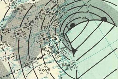
The second winter comparison I want to look at is the winter of 1960-1961 which has come up for discussion.There isn’t a whole lot on the internet about that winter however for some areas in New Jersey it stands among the top 5 or top 10 snowiest of winters and was highlighted by the January 21st Cat 3 Nor’easter that caused chaos at the inauguration of President Kennedy. The winter was long, cold, and had 3 major snowstorms that produced 1 foot plus amounts and was characterized by significant blocking. That will be the critical question going forward in the next few months. You can have snow without blocking. Last winter we had hardly any but the cold air was so overwhelming that it was around when the precip was around. So it can happen without that signature pattern but the events tend to be smaller in nature. And frankly we had 3 storms last year that produced 10 inch snowfalls with temperatures in the low to mid teens and that really inst a lot of fun.
So of course this begs the question of where are we now and where are we going with this? Honestly I do not have the answer yet. The answer may not become evident until it actually starts to show itself in the short range. Right now this first blast of record cold had no blocking to speak of and the result will be that the cold air will move out late this week and we will see temps go back to normal or a little above into early next week.
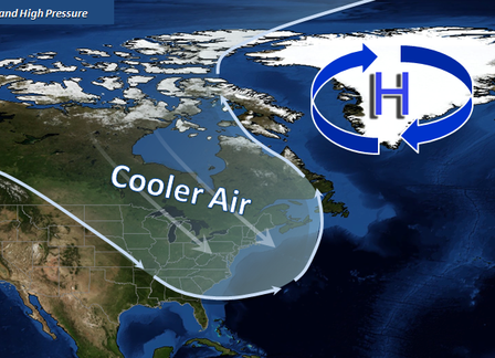
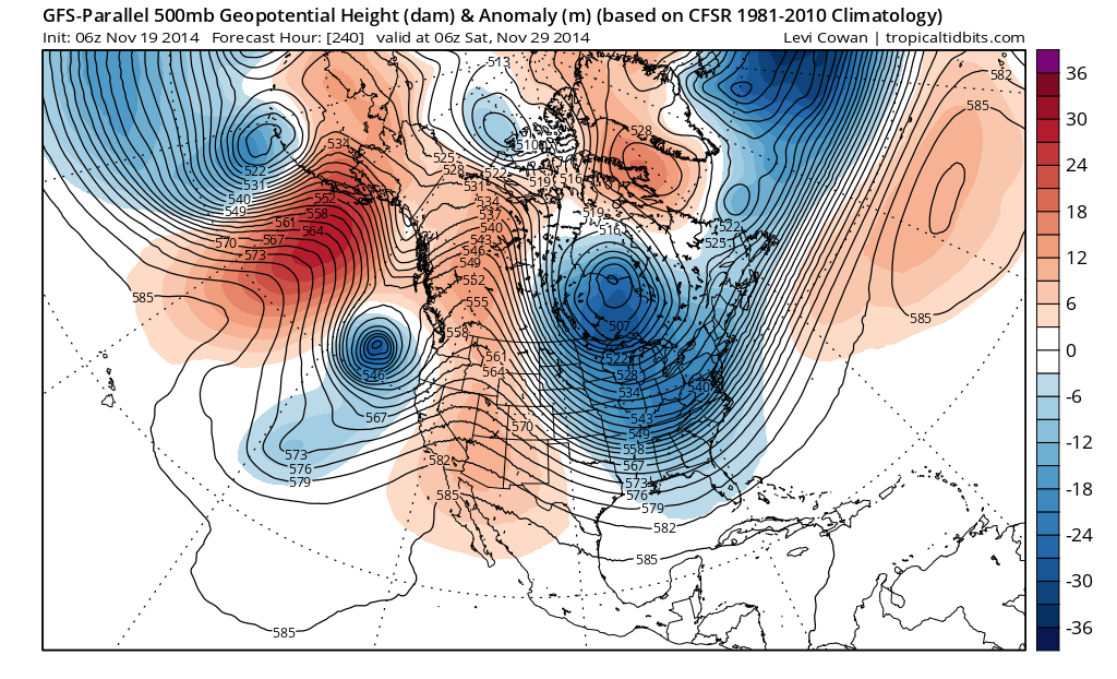
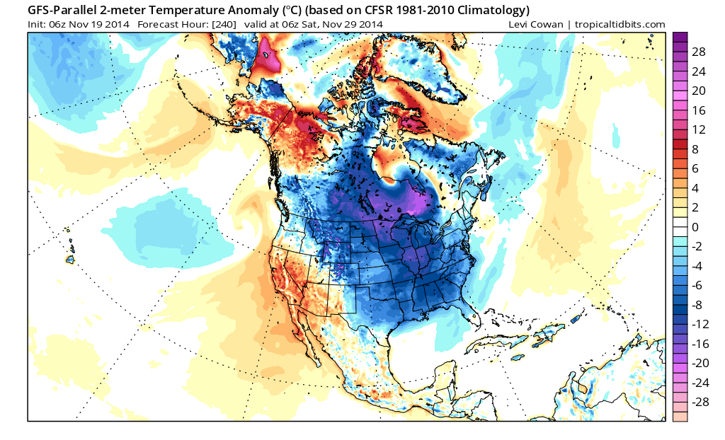
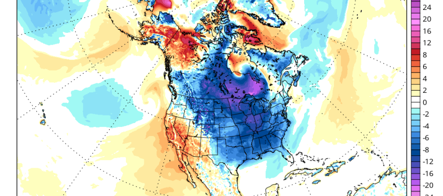
However it appears at least from the standpoint of the parallel GFS that we are reloading for the next cold air mass to arrive around or just after Thanksgiving. The flavor of the upper flow here is similar to what we just experienced and at least from this standpoint we look toward Greenland and notice no real signs of any kind of blocking. What we do see however is all the other major players in position to deliver more cold to the East Midwest and South. The vortex in Canada migrates south to just north of Lake Superior. The Aleutian Low is in place and all wrapped up and locked in. There is a strong flow from the pacific that may open up the southern stream jet which has storm implications for the east down the road. The one thing left to see is whether beyond this period, does blocking develop in the NW Atlantic to set up significant snow events for the east coast. The meteorological soap opera continues folks. Stay tuned!
In English: This winter has a similar start to cold and snowy winters in the past. The cold this week will not last yielding a warmer week next week before Thanksgiving. Afterward, the cold looks to return.
Joe Cioffi has been a meteorologist in the New Jersey/New York area for the last 30 years on NJ 101.5 radio and WPIX TV in New York. You can follow him on facebook (facebook.com/meteorologistjoecioffi) and Twitter (@joecioffi) or visit his website at www.meteorologistjoecioffi.com.
Jonathan Carr (JC) is the founder and sole operator of Weather NJ, New Jersey’s largest independent weather reporting agency. Since 2010, Jonathan has provided weather safety discussion and forecasting services for New Jersey and surrounding areas through the web and social media. Originally branded as Severe NJ Weather (before 2014), Weather NJ is proud to bring you accurate and responsible forecast discussion ahead of high-stakes weather scenarios that impact this great garden state of ours. All Weather. All New Jersey.™ Be safe! JC


