After another cold night tonight, temperatures will start to moderate tomorrow ahead of a low pressure disturbance moving up the coast. Given the track of the low pressure system, most of the state should expect rain with the exception of the higher elevations in NWNJ where a wet coating to a few inches are possible. If the low was further off the coast it would be a much different story but that won’t be the case. Clouds should increase throughout tomorrow with precipitation starting as early as tomorrow night. The heavier precipitation and mild-to-moderate winds should occur on Monday and clear out by early Tuesday morning, giving way to even colder conditions than now.
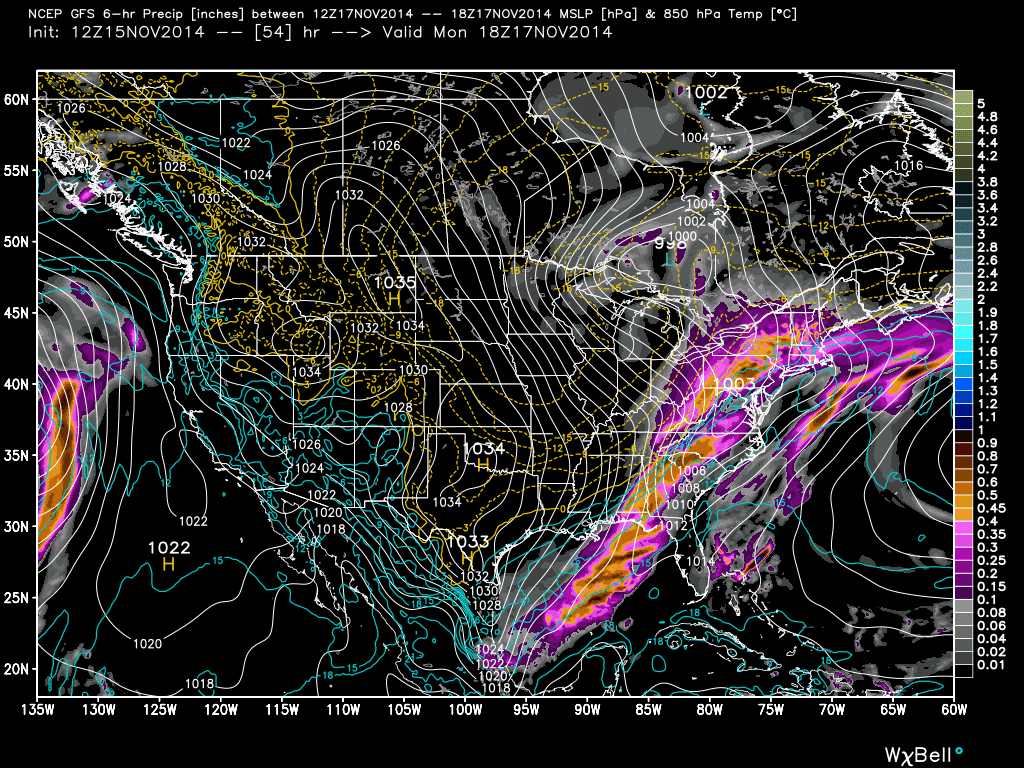
Let’s look at some supporting guidance. This is the newly upgraded GFS showing 850mb level pressure, temperature and precipitation falling between 7PM tomorrow night and 1AM Monday morning:
This is the same model and parameters for between 7AM Monday morning and and 1PM Monday afternoon:
Lastly…the same model and parameters for between 7PM Monday evening and and 1AM Tuesday morning:
In English: This is not a big deal. Most of the state should expect rain starting as early as tomorrow night and ending as late as early Tuesday morning making Monday a cold washout for all lower elevations. There will be some wind but nothing you’re not used to. Higher elevations of NWNJ have a small chance to start and end with a wintry mix—a wet coating to a few inches at most. They say back-end snow is an old wives tail but flurries could wrap up the system for many Monday night, especially with the Arctic air moving in. Watch out for black ice Tuesday morning! Hope you are staying warm and having a great weekend. Please be safe! JC
Jonathan Carr (JC) is the founder and sole operator of Weather NJ, New Jersey’s largest independent weather reporting agency. Since 2010, Jonathan has provided weather safety discussion and forecasting services for New Jersey and surrounding areas through the web and social media. Originally branded as Severe NJ Weather (before 2014), Weather NJ is proud to bring you accurate and responsible forecast discussion ahead of high-stakes weather scenarios that impact this great garden state of ours. All Weather. All New Jersey.™ Be safe! JC
