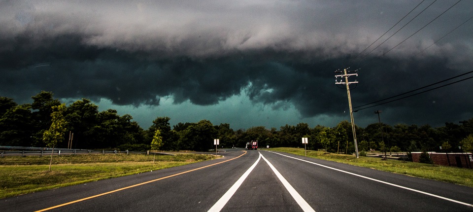
Discussion: The line of severe thunderstorms is currently pushing through EPA towards NJ. NWNJ is already up at bat with the rest of NJ on deck. This line should continue it’s NW to SE movement over the next 3-5 hours through NNJ, CNJ and parts of SNJ. The line might stall across extreme SNJ/SENJ overnight but with less convection due to marine layer interaction. This would likely present a flash flooding hazard across SENJ by tomorrow morning but with less overnight lightning than what we’re about to see in the next 3-5 hours.
Current instability is off the charts with many areas exceeding 4,000 j/kg of convective available potential energy. Wind shear and dew points are sufficient as is the lifting mechanism of the triggering cold front itself. Many will go from mid-summer feel to spring-feel depending on which side of the front you are on. It’s a classic severe thunderstorm setup so please take it seriously.
There are a few tornado warnings to our W in PA but none currently in New Jersey. With a linear frontal passage like this, straight-line wind gusts are more likely than rotating winds from a tornado. I’m not ruling out a tornado just stating the odds. Both straight-line and tornado winds are both dangerous and damaging so I simply suggest you prepare the same for either.
Lightning should be very frequent given the instability profile so please exercise lightning safety as well.
In English: Thunderstorms are moving through NJ from NW to SE and are capable of producing frequent lightning, damaging wind gusts, hail and flash flooding. They are already hitting NWNJ, should cross I-95 between 6-7pm and reach SENJ by 9-10pm. Please take any safety precautions now and get inside before the storm line hits. You’ll be able to see it coming from the NW. This should push through the northern 2/3 of NJ between now and 8pm but SNJ/SENJ might see continued rainfall overnight if the frontal boundary stalls over extreme SNJ (likely). Flash flooding is possible for anyone under the heavy storm line as it passes but especially for SNJ/SENJ if the front stalls overhead. Everyone please be safe! JC
Jonathan Carr (JC) is the founder and sole operator of Weather NJ, New Jersey’s largest independent weather reporting agency. Since 2010, Jonathan has provided weather safety discussion and forecasting services for New Jersey and surrounding areas through the web and social media. Originally branded as Severe NJ Weather (before 2014), Weather NJ is proud to bring you accurate and responsible forecast discussion ahead of high-stakes weather scenarios that impact this great garden state of ours. All Weather. All New Jersey.™ Be safe! JC
