March 3: Winter Storm Approaching

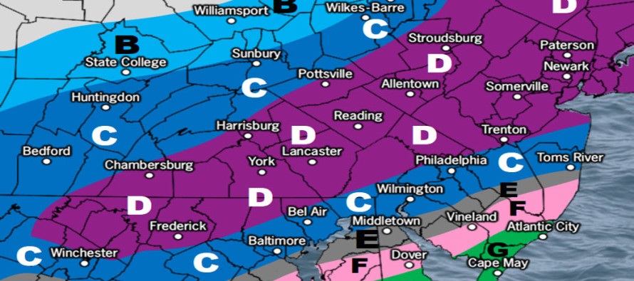
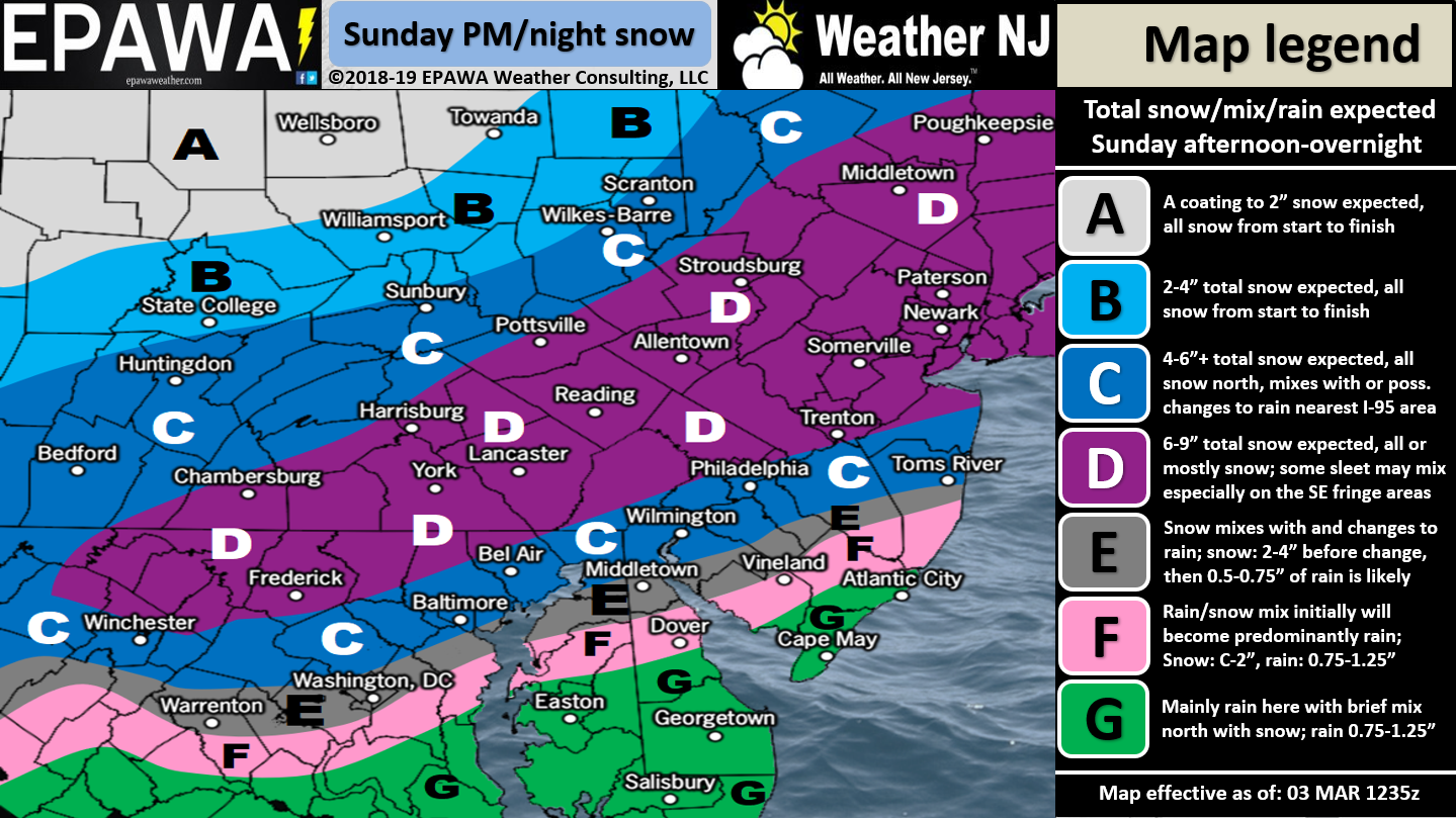
Click here for full-resolution snow map!
Discussion: I think the SE and colder trend has leveled off. Over the past few days we’ve watched a once amped interior snow storm (rain for most of NJ) trend into a weaker and faster snow storm for most of NJ less SENJ (zones F and G). This makes sense because when you decrease meridional axis you increase progressive flow W to E. The general upper-level pattern across the entire US is very zonal and flat. Therefore the “trend colder and SE” will theoretically result in more snow for more areas of NJ but at the cost of lesser amounts (we’ve seen bigger snow storms), a shorter duration event and a bump left in timing for start and end times. This system now looks to arrive by early afternoon for SWNJ, spread into all of NJ by 5pm and taper off just after midnight now. This should give road crews more time to clear before traditional school/business hours open Monday morning.
Zones D and C have the best chance for a Kaboom. Not a widespread Kaboom but possibly localized instances of 12″. This is a small possibility and should not be banked-on. I’ll explain. The dynamics involved with this snow storm are very amped almost like a summer-time thunderstorm. Specifically the possibility of convective instability is what we’re seeing. Basically the surface will be warmer than aloft and heat likes to rise right? Therefore you have that instability wanting to aid in lifting along with a solid lifting trigger (a passing sub-1000mb surface low). We feel the best chance for this convective enhancement is right along I-95 and maybe 30 miles to the NW of I-95/20 miles to the SE of I-95. NWNJ could actually be too far NW for this. Within that zone (30 miles NW of I-95/20 miles SE of I-95) convective instability could lead to possible thundersnow. The great Jim Cantore once said “when you hear thundersnow add at least 3 inches to your snow totals.” therefore that could put the referenced area of interest into the Kaboom zone. I emphasize “could” because again this is only a possibility not a strong probability.
My gut feeling says zone E could go either way (like C or F) especially through Burlington and Ocean County. This area should go over to rain eventually but the front-end snow thump could possibly surprise before the changeover. In the other wildcard direction zone E could see more warm air advection in the critical low-mid levels (925-700mb) and changeover faster. So zone E is very uncertain.
Zones F and G are favored to change to rain the quickest. Could some zones of F squeeze out 3″ before the changeover? I suppose if the front-end thump surprises. Otherwise I just don’t see either zones (F and G) escaping the coating-2 inch category especially once the rain begins washing such trace/light accums away. I know you are all seeing winter storm warnings for 4-7″ inches in counties like Ocean/Burlington but NW Ocean/Burlington and SE Ocean/Burlington should behave very differently.
After this system moves out a large broad trough of cold air should dominate the NJ pattern through Friday. The next storm signal is March 9.
In English: Precipitation should start as early as noon in extreme SWNJ and spread northeastward through all of NJ by 5pm. Initial precipitation should be light and possibly rainy but should change to all snow for most of NJ especially by sundown. A snow/rain line should advance from S to N from SENJ until about I-95/NJTP between precip start and 10pm. Therefore this is a snow to rain situation for areas SE of I-95/NJTP. The further NW you are (closer to the turnpike) the more of a snow thump you should see before the changeover. Extreme SNJ/SENJ (AC down through Cape May/Cumberland) have the best chance to start and stay all rain. Areas along and NW of I-95/NJTP are in the jackpot zone (possibly the Kaboom zone – see above discussion – zone C has a + for a reason). Heavy rates of snowfall are likely in said areas with a small chance of thundersnow. Basically it’s going to rip snow along and NW of I-95/NJTP from about 6pm to 2am with one inch+ per hour snowfall rates on the table. Precipitation should end for all areas between midnight and pre-dawn hours. I’ll post radar updates and live observation threads later today when the system gets going. Have a great rest of your SUnday and please be safe! JC
Download the new free Weather NJ mobile app on Apple and/or Android. It’s the easiest way to never miss Weather NJ content. Our premium services go even further above and beyond at the hyperlocal level.
Jonathan Carr (JC) is the founder and sole operator of Weather NJ, New Jersey’s largest independent weather reporting agency. Since 2010, Jonathan has provided weather safety discussion and forecasting services for New Jersey and surrounding areas through the web and social media. Originally branded as Severe NJ Weather (before 2014), Weather NJ is proud to bring you accurate and responsible forecast discussion ahead of high-stakes weather scenarios that impact this great garden state of ours. All Weather. All New Jersey.™ Be safe! JC


