Mar 18: Snow Map for Friday

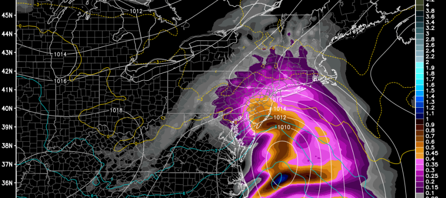
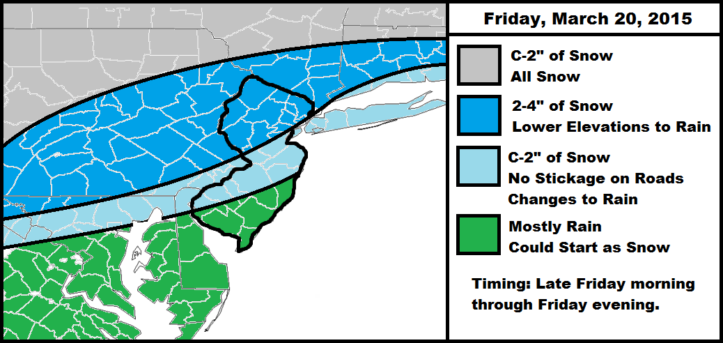
This is a pretty straightforward low pressure disturbance that will eject into the Atlantic Ocean near the VA/NC border this Friday. It will bring snow and rain to the region despite a warmer surface temperature profile. Accumulations will have trouble stacking up along and SE of the I-95 corridor, especially on paved surfaces and in big city areas. Natural surfaces have the best chance of accumulations, especially for interior elevations. With that said, NWNJ and parts of NENJ could still squeeze out a few inches from this. Most of SNJ and the coast should expect rain after possibly starting as non-accumulating snow.
Winds will be pretty run-of-the-mill for a weak low pressure disturbance. Expect 30-40mph wind gusts along the coast and lesser amounts for interior NJ. They will rock from S to E to N throughout the duration of the event (Friday morning through Friday evening).
Snow is far from uncommon in March, however the higher sun angle will take a toll on accumulations. Because most of the precipitation will occur during the day, diurnal surface heating should keep all roads driveable on the coastal plain. You’ll have to go up at least 800-1200 feet to see accumulations on paved surfaces. That’s about all you can say for this system.
In English: A nuisance wintry event will take place this Friday between late morning and evening. Expect non-accumulating snow changing to rain for lower elevations of NJ (especially the coast). Expect a few inches of snow accumulation for interior elevations. Temperatures rebound above freezing for the weekend so it won’t stick around long at all, if you can pardon the pun. Be safe! JC
Jonathan Carr (JC) is the founder and sole operator of Weather NJ, New Jersey’s largest independent weather reporting agency. Since 2010, Jonathan has provided weather safety discussion and forecasting services for New Jersey and surrounding areas through the web and social media. Originally branded as Severe NJ Weather (before 2014), Weather NJ is proud to bring you accurate and responsible forecast discussion ahead of high-stakes weather scenarios that impact this great garden state of ours. All Weather. All New Jersey.™ Be safe! JC


