Light Snow Event Underway

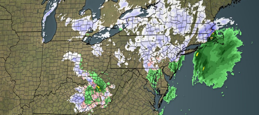
Discussion: Precipitation is underway but overall light so far. Areas N of I-78/NW of I-287 are cold enough for snow accumulation while all areas SE are still too warm. The line of freezing and snow/rain line has just started to push SE away from the I-78/I-287 contour and is heading towards the I-95 corridor. These key lines will continue advancing SE until they reach the SENJ coast after midnight.
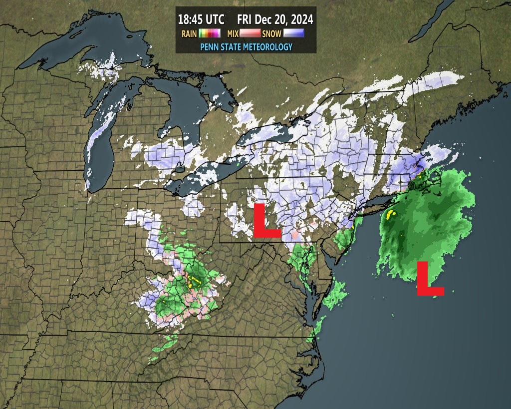
The offshore coastal is maturing as the clipper decays. A quick snapshot of the Penn State Met Radar illustrates the following location of the lows (N stream decaying clipper over E US – S stream developing offshore low over ocean:

There are no changes to our snow map issued yesterday. In general, we still feel that areas NW of I-95 have the best chance to see a coating to two inches of snow, maybe higher locally to elevations. We also still believe that areas SE of I-95 are going to struggle to exceed a coating on natural surfaces. The closer you are to I-95, the better chance for a coating. Extreme SENJ has the least chance for a coating but could see some flurries mix in with tail-end precip overnight.
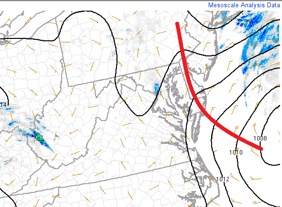
There are currently no signs of where the InVerted Trough (IVT) is going to set up the strongest but based on some isobar kinking from SPC mesoscale analysis, we can see that it’s at least starting in this area.
This IVT is weak, NOT a NORLUN…just an IVT. Therefore, we’re not talking about isolated 3-6+ inches of snow like a NORLUN. We are likely looking at an additional C-2 for wherever ultimately drops the snow. This will be discovered and confirmed later tonight with radar and pressure observations. All precipitation should end by sunrise Saturday morning and temps should continue their dive into the coldest air mass of the late year Saturday night through Sun/Mon into Tuesday (fitting for the calendar start of winter). Still expecting a warmup between Christmas Day and New Year’s Day followed by the return of colder air shortly after such.
In English: Precipitation is underway and a snow/rain line is establishing just NW of I-95. Surface temperatures will now drop from here through this evening. By midnight, or just after, all NJ areas should be over to snow. Snow should end by sunrise Saturday morning. No changes to our forecast yesterday. Anything from a coating to a few inches NW of I-95 and likely just a coating SE of I-95 (except for maybe extreme SENJ – LBI/AC/Cape May/etc.). Inverted trough influence could provide another inch or two in localized/isolated nature but impossible to pinpoint until it happens. This was never a big snow but let’s be honest, even trace-to-light snow accumulations are a big win for holiday look and feel. For the baseball analogy, this is a leadoff hit in the first inning with a very long game to go. Be safe! JC
Premium Services
KABOOM Club offers ad-free content, inside info forecast discussion, your questions answered, and early storm impact maps and video releases (ahead of the public). At two bucks per month, it’s an extremely feasible way to show additional support for Weather NJ. Think of it as a tip jar with perks. Available onFacebook or Patreon.
My Pocket Meteorologist (MPM), in partnership with EPAWA Weather Consulting, offers professional/commercial interests, whose businesses depend on outdoor weather conditions (snow plowing, landscaping, construction, etc.), with hyper-local text message alerts/forecasts and access to the MPM premium forum—the most comprehensive and technical forecast discussion available for PA and NJ.
Jonathan Carr (JC) is the founder and sole operator of Weather NJ, New Jersey’s largest independent weather reporting agency. Since 2010, Jonathan has provided weather safety discussion and forecasting services for New Jersey and surrounding areas through the web and social media. Originally branded as Severe NJ Weather (before 2014), Weather NJ is proud to bring you accurate and responsible forecast discussion ahead of high-stakes weather scenarios that impact this great garden state of ours. All Weather. All New Jersey.™ Be safe! JC


