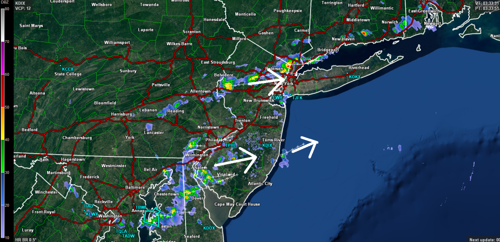
A cold front is moving through PA towards NJ. Ahead of it lies destabilized and unsettled air mass currently responsible for widely scattered showers and thunderstorms. There’s hardly any wind shear so these are mostly instability-driven with tropical surface fuel (dew points above 70). This traditionally results in short pulsing (on radar) storms that pack a quick downpour punch with a few strikes of lightning. All thunderstorms so far have failed to meet severe criteria and are therefore considered just strong thunderstorms. NNJ has seen a bit more precipitation than other parts of NJ due to the training nature of the storms between the I-78 and I-80 area. Some more showers and thunderstorms are currently moving into SNJ (between Philadelphia and Cape May) from the west.
Expect these humid and stormy conditions to last into the overnight hours with more showers and storms possible tomorrow. Be safe! JC
Jonathan Carr (JC) is the founder and sole operator of Weather NJ, New Jersey’s largest independent weather reporting agency. Since 2010, Jonathan has provided weather safety discussion and forecasting services for New Jersey and surrounding areas through the web and social media. Originally branded as Severe NJ Weather (before 2014), Weather NJ is proud to bring you accurate and responsible forecast discussion ahead of high-stakes weather scenarios that impact this great garden state of ours. All Weather. All New Jersey.™ Be safe! JC
