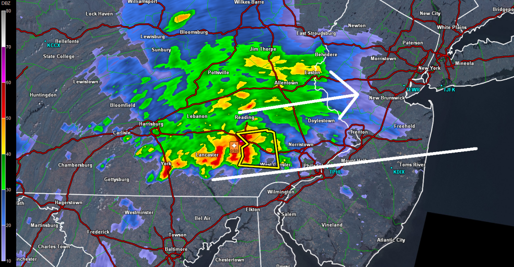
Thunderstorms are moving into western New Jersey (Philly-northward). They will continue to push ENE until they clear out to sea. These storms should continue to push towards the NYC Metro area overnight. Due to cooler air aloft, there are many reports in EPA of hail. There are lots of frequent lightning and heavy downpour reports as well. SNJ might very-well miss out tonight due to drier air associated with the jet stream. Everyone north of I-195 (Trenton<->Belmar) should get in on these.
Everything should be gone by sunrise despite leaving another unsettled day tomorrow. I think the best action tomorrow will be towards the southern regions of our coverage area. Live-casting continues. Please be safe. JC
Jonathan Carr (JC) is the founder and sole operator of Weather NJ, New Jersey’s largest independent weather reporting agency. Since 2010, Jonathan has provided weather safety discussion and forecasting services for New Jersey and surrounding areas through the web and social media. Originally branded as Severe NJ Weather (before 2014), Weather NJ is proud to bring you accurate and responsible forecast discussion ahead of high-stakes weather scenarios that impact this great garden state of ours. All Weather. All New Jersey.™ Be safe! JC
