July 20: Nuisance at the shore

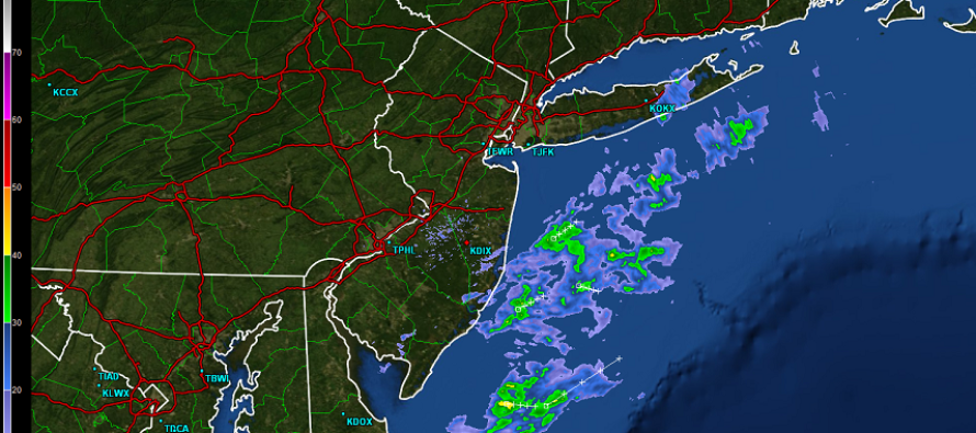
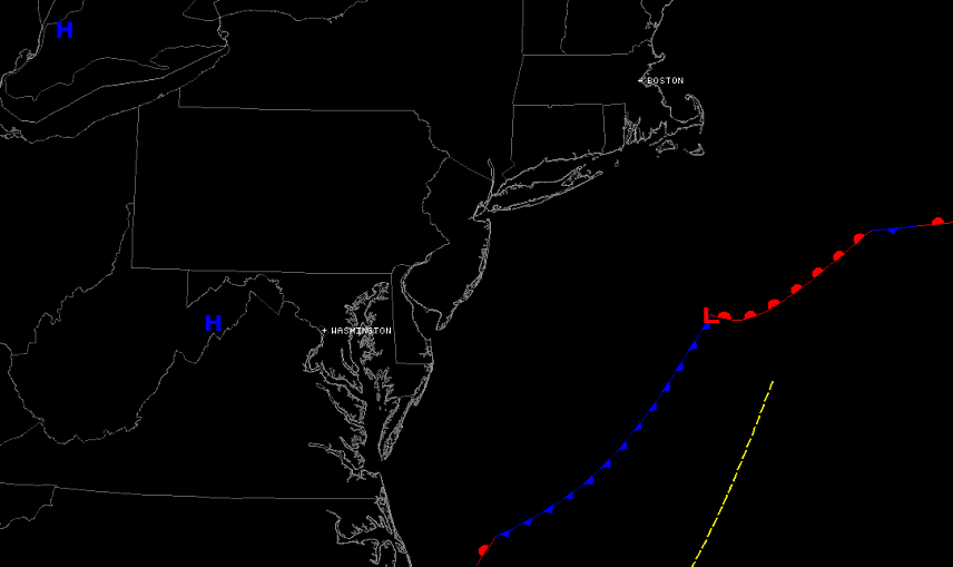
A weak area of low pressure is riding a stationary boundary about 200 miles offshore. High pressure is keeping this boundary out to sea but the overall conflict between high and low pressure is maintaining an onshore flow from the NE. In English…the outer fringe elements of a weak passing fish storm are creating nuisance conditions for coastal/SENJ. Interior regions, especially NWNJ, are seeing a mixed bag of sun and clouds and generally nice day. This is why I had to give today a 25% chance of this happening for SENJ. The radar shot above shows you how close the outer bands of rain are to the coast. Expect these outer bands to linger into the evening hours before pulling away with the low.
The following image shows you the relative frontal boundary and current position of the surface low. Also note the high pressure sitting over WV/VA.
This coming week we’ll return to typical summery conditions for July. The traditional mid-summer SE ridge will establish itself on the shoulders of the Bermuda high. This will drive warm sub-tropical sir into the NJ region from the south. Naturally that will increase storm chances. I’ll have a fully detailed outlook for the week posted later this evening. Be safe! JC
Jonathan Carr (JC) is the founder and sole operator of Weather NJ, New Jersey’s largest independent weather reporting agency. Since 2010, Jonathan has provided weather safety discussion and forecasting services for New Jersey and surrounding areas through the web and social media. Originally branded as Severe NJ Weather (before 2014), Weather NJ is proud to bring you accurate and responsible forecast discussion ahead of high-stakes weather scenarios that impact this great garden state of ours. All Weather. All New Jersey.™ Be safe! JC


