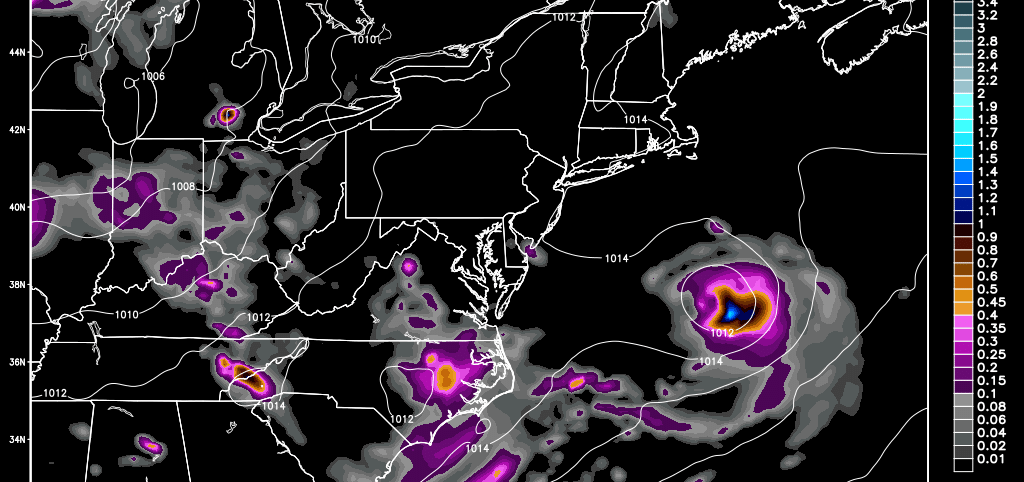
A low pressure disturbance should form in the OBX area tomorrow and track NE through Monday—well out to sea and SE of New Jersey. The system could actually pass over warmer gulf stream waters and develop tropical convection. The only reason this is worth mentioning is because of potential surf impacts during peak beach season. With that said, strong rip currents and slightly elevated wave heights are possible between Sunday evening and Tuesday morning. Please use caution and respect/listen to life guards and local authorities along coastal regions.
The Euro, GFS and NAM are all on board with this happening. Here’s the latest NAM showing the system’s expected position at 11AM on Monday:
In English: So that it’s perfectly clear, this system has no chance to hit New Jersey. Despite a mostly sunny/warm Sunday and Monday expected on land, the ocean could be rough and/or contain strong rip currents. Surf conditions should subside by Tuesday morning but I’d give it until Tuesday afternoon to be conservative. Please be safe! JC
Jonathan Carr (JC) is the founder and sole operator of Weather NJ, New Jersey’s largest independent weather reporting agency. Since 2010, Jonathan has provided weather safety discussion and forecasting services for New Jersey and surrounding areas through the web and social media. Originally branded as Severe NJ Weather (before 2014), Weather NJ is proud to bring you accurate and responsible forecast discussion ahead of high-stakes weather scenarios that impact this great garden state of ours. All Weather. All New Jersey.™ Be safe! JC
