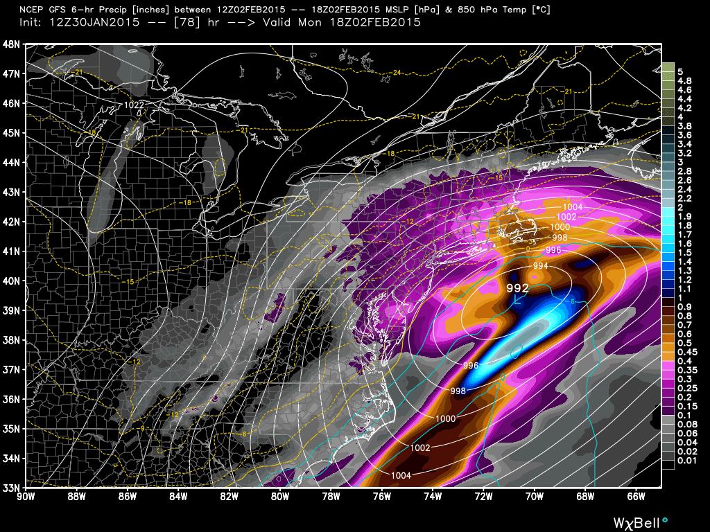
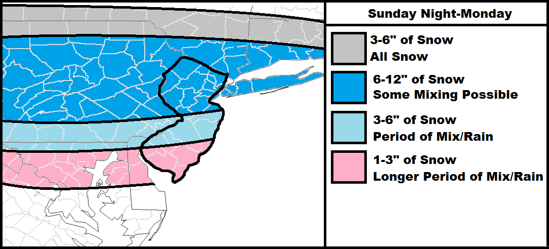
Models have trended northward to the point where New Jersey is no longer on the northern fringe of precipitation. The latest guidance suggests NNJ seeing the snowiest solution, CNJ still seeing significant snowfall, and SNJ seeing light snowfall with mixing. We have decent suppression force to our north consisting of high pressure and Arctic reinforced air. We also have, however, a strong subtropical jet flow to our south. These forces are going to collide and provide the flat W-to-E snow swath shown on the above map. Due to such strong north and south forces, there is high volatility in this forecast. If the northern forces are slightly stronger then it will be a snowier solution with the jackpot zone running more through CNJ than NNJ (SNJ would then see light blue area). If the northern model trend continues then everything on the map could shift slightly northward. This is what I’ll be paying close attention to which will determine my updated snow map tomorrow evening. My final call will be issued on Sunday just before the big game. For now, this is the best read I can give based on current guidance and pattern obs.
In English: Snow is currently expected to move into our region from the W Sunday night. NNJ has the best chance for all snow. CNJ could see mixing but still deliver the significant accumulations shown on map above. SNJ would see more mixing but still result in light accumulations. I’ll be watching the models overnight tonight and tomorrow for any trending that occurs. Be safe! JC
Model image used with permission from WeatherBell Analytics.
Jonathan Carr (JC) is the founder and sole operator of Weather NJ, New Jersey’s largest independent weather reporting agency. Since 2010, Jonathan has provided weather safety discussion and forecasting services for New Jersey and surrounding areas through the web and social media. Originally branded as Severe NJ Weather (before 2014), Weather NJ is proud to bring you accurate and responsible forecast discussion ahead of high-stakes weather scenarios that impact this great garden state of ours. All Weather. All New Jersey.™ Be safe! JC

