Jan 17: Coastal Rain Storm Approaching!

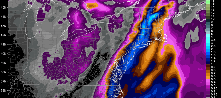
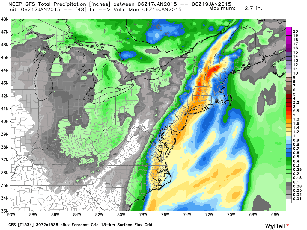
A low pressure disturbance will form close to the mid-Atlantic coast Sunday morning and track into New England. This should bring a period of moderate-to-heavy rain to New Jersey from Sunday morning through early Monday AM. The coast is modeled to see more precipitation than further interior regions of NJ. Cold air will be rushing in behind this disturbance but not quick enough to result in significant wintry precipitation-perhaps a few flurries on the tail end. If the low tracked further off the coast, there would be more of a wind threat but that’s not the case with this coastal hugger.
Here’s the total expected precipitation (in liquid inches) over the next 48 hours according to the GFS:
In English: Expect rain to start as early as tomorrow morning and clear as late as early Monday AM hours. Expect more rain closer to the coast than in western NJ. Cold will rush in behind and set up average temperatures for January. I’m still watching a probable mid-week clipper to bring light snow to the region as well as a possible larger event next weekend. I’ll have a detailed update on both systems after tomorrow afternoon’s model guidance. In the meantime stay dry and be safe! JC
Jonathan Carr (JC) is the founder and sole operator of Weather NJ, New Jersey’s largest independent weather reporting agency. Since 2010, Jonathan has provided weather safety discussion and forecasting services for New Jersey and surrounding areas through the web and social media. Originally branded as Severe NJ Weather (before 2014), Weather NJ is proud to bring you accurate and responsible forecast discussion ahead of high-stakes weather scenarios that impact this great garden state of ours. All Weather. All New Jersey.™ Be safe! JC


