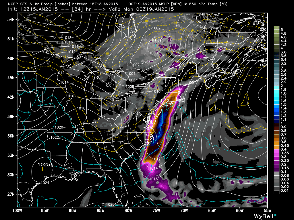
Low pressure will form off the coast of Virginia Sunday morning and track to the N/NE bringing possibly heavy rain and moderate wind to New Jersey from Sunday morning through early Monday AM. Expected rainfall amounts range from .25 to 1.25 inches from NNJ/WNJ to SENJ. NWNJ could see very little precipitation from this. The latest model guidance favors more rain along the coast. Should any local intense bands of precipitation develop, 2 inches wouldn’t be out of the question with possible flash flooding issues locally. Expected E/NE winds should range from 15-25mph with gusts to 35mph. They will be felt more along the coast than inland while the storm is to our S/SE. Only minor beach erosion is possible from a temporary period of rough surf but no significant tidal flooding is expected. Once the center of the low gets closer to E. Long Island/Coastal New England, the winds will shift to the N and drop temperatures below freezing. Will have to monitor icy roads overnight into Monday. Back-end flurries are possible for any lingering precipitation behind the cold front (likely NNJ only). Let’s look at the latest 12Z GFS guidance, specifically 850mb pressure, temps and precipitation.
Between 7AM and 1PM on Sunday:
Between 1PM and 7PM on Sunday:
In English: Expect some rain and wind from Sunday morning through Sunday night, especially along the coast. It should clear out by the early AM hours of Monday. The weekend looks relatively dry, cold and calm until then. Only a chance of a flurry from lake effect snow tomorrow and probably only for NWNJ. I’ll have the full Weekend Outlook posted tomorrow morning. Be safe! JC
Model graphics used with permission from WeatherBell Analytics.
Jonathan Carr (JC) is the founder and sole operator of Weather NJ, New Jersey’s largest independent weather reporting agency. Since 2010, Jonathan has provided weather safety discussion and forecasting services for New Jersey and surrounding areas through the web and social media. Originally branded as Severe NJ Weather (before 2014), Weather NJ is proud to bring you accurate and responsible forecast discussion ahead of high-stakes weather scenarios that impact this great garden state of ours. All Weather. All New Jersey.™ Be safe! JC
