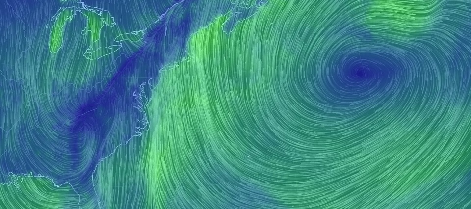
Discussion: We’re now in a little break between precipitation bands. More periods of rain are expected on and off heading into this weekend. The latest mesoscale models indicate two more periods of at least moderate rainfall. The first should occur between about 6-10PM (SNJ to NNJ) and the second between 1-5AM tomorrow morning (WNJ to ENJ). That would allow another small break in the precipitation between about 10PM and 1AM as the low brings the tip of the warm sector through ahead of the cold front. We will likely stay on the mild side until the cold front crashes through tomorrow morning. At this point I am feeling more confident about less icing potential in NWNJ tomorrow morning. There still exists a small chance but precipitation looks like it will shut off before cold-enough air arrives.
Temperatures should then fall steadily tomorrow, after the rains stops, through Sunday morning. A rapid freeze possibility exists as early as tomorrow morning. I expect surface temperatures to fall below freezing by 10AM tomorrow morning and to continue falling into a very cold Saturday night into Sunday. We’re talking overnight lows ranging from 5-15 from NNJ to SNJ. NW winds will reinforce a colder feel through Monday which brings us to our discussion about next week’s potential snow event.
For some time now a weaker clipper-style event has been showing for Tuesday. We’re talking about a C-2″ event of powdery stuff. I was never really enthused about this but it is indeed a light event and Tuesday is quickly approaching. The Euro however has been slowly leaning towards a coastal low popping for Wednesday into Thursday. This would be from the original clipper energy digging deeper to the south into a trough that rapidly enhances and brings the coastal surface low closer up the coast. Therefore the Euro actually fizzles the Tuesday event out into almost nothing and drops a more significant event on New Jersey for Wednesday-Thursday. The GFS and other guidance are suggesting that the coastal low stays too far out to see. So we’re still in model mayhem for now.
The energy responsible for the Wednesday-Thursday potential is not yet onshore. It is still in the Pacific Ocean over poorly-sampled data regions. Said energy should be over the west coast of North America, over abundant data sampling, as early as Sunday. This is when models should begin to lock onto a more consensual solution. For now, both the Tuesday clipper and the Wednesday-Thursday coastal have my attention and I will monitor closely.
In English: More rain is expected tonight through tomorrow morning. Rain should be on and off, heavy at times, and you cannot rule out a few boomers early tomorrow morning. NWNJ icing chances have decreased some, primarily and only for Sussex and Warren Counties. I think we’re leaning more towards the rain ending before it can change its precipitation type to wintry. Watch out for a rapid freeze as early as tomorrow morning however. Temperatures will be crashing hard tomorrow once the rain ends. Whatever doesn’t evaportate and/or isn’t treated will certainly freeze. Roadway treatment is likely needed. Temperatures then bottom out in the single-digits/teens by early Sunday morning and we stay colder into next week.
Next week holds two different snow potentials (two different time periods) from the same energy. First is a lighter event for Tuesday and second is a more significant coastal storm for Wednesday into Thursday. Serious tracking will begin Sunday. I’m shooting for an 11AM video tomorrow morning to see where we stand. Neither system is a guarantee at this point but both command close monitoring moving forward. Have a great rest of your Friday and please be safe! JC
For comprehensive and interactive hyper-local analysis that goes way above and beyond the detail of this public forecast, check out our premium services which include text notifications and forum access.
Jonathan Carr (JC) is the founder and sole operator of Weather NJ, New Jersey’s largest independent weather reporting agency. Since 2010, Jonathan has provided weather safety discussion and forecasting services for New Jersey and surrounding areas through the web and social media. Originally branded as Severe NJ Weather (before 2014), Weather NJ is proud to bring you accurate and responsible forecast discussion ahead of high-stakes weather scenarios that impact this great garden state of ours. All Weather. All New Jersey.™ Be safe! JC
