Jan 10: Monday Ice Storm Detected!

I’m ready to make the following initial forecast for Monday’s winter storm:
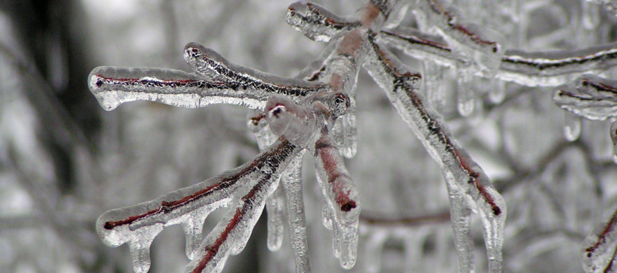
Tonight’s low temperatures will range from single digits in NWNJ to the teens in SENJ. Tomorrow temperatures stick their head above freezing during the day before falling back below freezing overnight into Monday morning. Precipitation will then move into the region from the SW early Monday morning and probably clear out during afternoon hours. Warm temperatures will invade the mid levels of the atmosphere while the surface remains cold. With that being said, we’re looking at an ice storm signature for areas that still have surface temperatures below freezing.
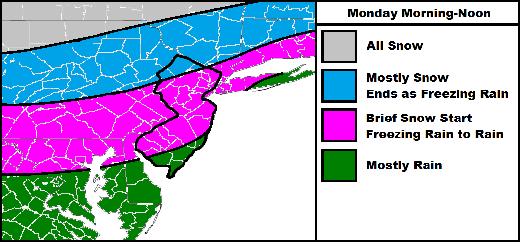
SENJ and all other areas in green might see a little wintry precipitation to start overnight but will be the first areas to warm at the surface and go to rain. Pink areas are subject to the surface holding on to below freezing temperatures longer which means more freezing rain before changing to rain to finish. Pink areas could see a brief period of snow to start but that will have to be live-casted. The Blue areas should see more snow to start but end as freezing rain. Gray areas will likely stay all snow with light accumulations.
What could go wrong with this forecast? If the powerful high over the Great Lakes has more influence it could result in a colder storm. Also there will still be a decent amount of existing snow pack that could hold onto a colder surface temperature profile. Also we are looking at most precipitation occurring before peak temperature hours on Monday afternoon. Those are the colder scenario wild cards. If the high has less influence and warm air advection has more of an overpowering effect on the lower and mid-levels of the atmosphere, the storm could be warmer too. I give these colder/warmer wildcards a 10% chance each with an 80% chance of the above map verifying.
In English: NWNJ should prepare for snow to freezing rain. SENJ should prepare for a little bit of wintry precip to start but mostly rain. Everyone in between should prepare for a decent icing event before changing over to rain. I’ll have a final map posted tomorrow including snow and ice accumulation amounts for CNJ and NNJ. I’ll also include the latest on the Wed-Friday situation (models all over). Ice scares me more than snow regarding travel and most of this should happen during Monday AM rush hour…so plan on delays (flights, public transportation, school closings, highways, etc.). Then we have to worry about black ice Monday night as temperatures fall back below freezing. Please be safe! JC
Jonathan Carr (JC) is the founder and sole operator of Weather NJ, New Jersey’s largest independent weather reporting agency. Since 2010, Jonathan has provided weather safety discussion and forecasting services for New Jersey and surrounding areas through the web and social media. Originally branded as Severe NJ Weather (before 2014), Weather NJ is proud to bring you accurate and responsible forecast discussion ahead of high-stakes weather scenarios that impact this great garden state of ours. All Weather. All New Jersey.™ Be safe! JC


