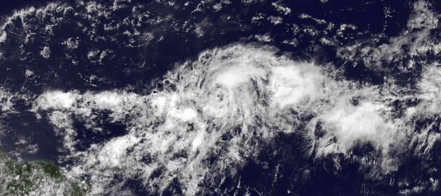
Hurricane Danny, per latest data, has intensified down to a 992mb low pressure center. Sustained max winds are now up to 75mph. He is currently moving towards the NE region of the Caribbean as most model guidance suggested over the last 48-72 hours. Estimated timing impact for the Lesser Antilles and E. Caribbean region looks like Monday-Tuesday based on current speed, heading, and downstream dynamics. Here’s the latest data that should be used to formulate the 11AM NOAA NHC update: AL, 04, 2015082012, , BEST, 0, 123N, 444W, 60, 992, TS, 50, NEQ, 20, 20, 10, 20, 1011, 150, 10, 0, 0, L, 0, , 0, 0, DANNY, D, 0, , 0, 0, 0, 0, genesis-num, 013.
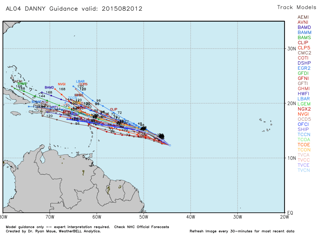
While intensification may continue over the next 24-48 hours, weakening is expected upon Caribbean approach/entrance as a strong wind shear environment coupled with higher elevation disruption could shred Danny apart. This might be the end. It might not. Only a small remnant would be needed to enter the Bermuda Triangle to re-intensify for US impact or an out to sea miss (fish storm). With that said, track beyond the NE Caribbean is still very uncertain but it DOES look like it will try to avoid a southerly path through the Caribbean Sea and into the Gulf of Mexico. Here’s the latest tropical spaghetti plot, used with permission from WeatherBell Analytics:
No threat to US can be confidently stated at this point. This is, however, starting to become an issue worth following for those traveling to the E. Caribbean region this weekend/early next week and possibly the Greater Antilles/Bahamas region later next week. I will continue to monitor this system as it further evolves and begins to narrow its cone of uncertainty track. In the meantime, the tropics are starting to heat up as another area is currently under investigation near Bermuda. Let’s revisit that tomorrow as the NHC only has a 10% chance of development over the next 48 hours. Be safe! JC
Jonathan Carr (JC) is the founder and sole operator of Weather NJ, New Jersey’s largest independent weather reporting agency. Since 2010, Jonathan has provided weather safety discussion and forecasting services for New Jersey and surrounding areas through the web and social media. Originally branded as Severe NJ Weather (before 2014), Weather NJ is proud to bring you accurate and responsible forecast discussion ahead of high-stakes weather scenarios that impact this great garden state of ours. All Weather. All New Jersey.™ Be safe! JC

LOCAL FORECAST | INTERACTIVE RADAR | LATEST NJ WEATHER ALERTS | WEDDING FORECAST| PRIVACY POLICY
© Copyright 2025 Weather NJ LLC. All Rights Reserved.
Some information that can be found on our website is provided by a private weather station and is not an officially recognized station for weather reporting. Though we always strive to achieve accurate reporting for our own use, it is important that you do NOT depend on the data provided here for any purpose.


