For the First Time in Forever

Discussion: First and foremost, everyone please have a safe and Happy New Year! That includes this evening and all of 2024.
I know the snow lovers out there are disappointed with the first third of Winter 2023-2024. An east-based El Nino has produced a milder and rainier December, as it historically and traditionally does. If you’ve been following Bobby Martrich’s (EPAWA) analysis, he’s been talking about how the Nino has/is transitioning from east-based to more of a distributed look for the warmest Sea Surface Temperature Anomalies (SSTA). This exact process is beneficial for snowstorm development in the E US, as long as conditions temporarily align.
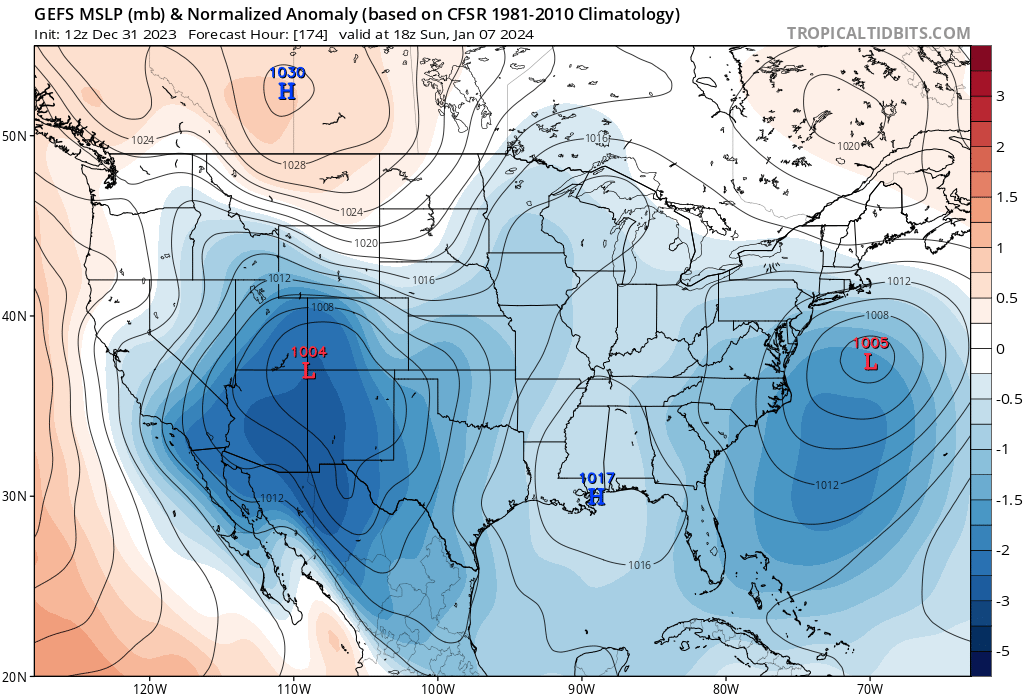
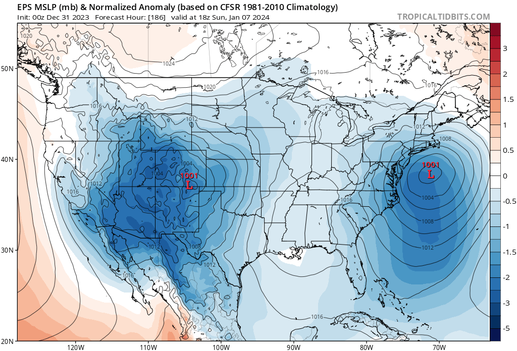
Well, there’s some model data evidence that things might be aligning. At this time, I HIGHLY recommend not placing any faith into a snowstorm next weekend (Jan 6-8). The pattern is changing (as I mentioned above), and models are having a hard time getting a handle on the change. The GFS, over the last 3-4 runs, has been spitting out a snowy solution for NJ despite a northward tick each run. From this range (7 days away) it is a much safer approach to look at the ensembles rather than deterministic model runs. Ensembles are clusters of multiple runs that each start with slightly different data conditions. The multiple runs are then analyzed for mean averages and this type of data approach has worked better in the past for long-range signals becoming threats. With that said, the GFS ensembles (top) and Euro ensembles (bottom) both see this storm system with a low in favorable position for a snowstorm + adequate cold air mass to support snowfall.


The surface low associated with this possibility actually comes off the Pacific into California. It then tracks across the US, dipping south to ~TX latitude before returning to benchmark latitude without any transfers. Kind of reminds me of the January 2016 setup regarding track. But there’s no ridge in the W US. It would be upper-level features ahead of the low that would need to work out in this case, not behind the low. But the main takeaway is that it could work out.
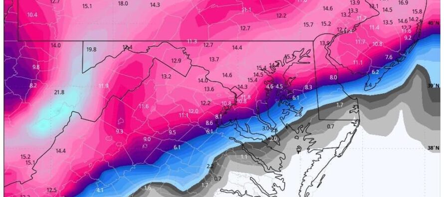
The cover image of this article is what is known as a clown map showing total snowfall from the overnight GFS run. This is not my forecast but conveys what is possible should all these conditions align and hold into this coming weekend. I will look for ensemble consistency, on multiple model runs/suites now, through about Tuesday night. If the models are still suggesting this on Wednesday then it will be time to sound the alarms. Again, I don’t want anyone getting too excited here. This could very well drop off or trend inland towards a rain solution (as the original storm signal first suggested). This is just something to monitor and watch because there hasn’t been any other larger snow threats in a long time. Let’s see how things look tomorrow.
In English: For the first time in forever, a snowstorm signal is showing for this next coming weekend (Jan 6-8). It’s early (~7 days away) so don’t get too excited yet. It could easily drop off or trend warmer like the original storm signal suggested. But today’s data is suggesting at least something happening next weekend. At this point, just know the possibility is there. I will monitor until Tuesday night. If it’s still there then it will be time for serious snowstorm tracking from Wednesday morning into the event. Happy New Year and please be safe! JC
Premium Services
KABOOM Club offers inside info forecast discussion, your questions answered, and early storm impact maps (ahead of the public). At a buck per month, it’s an extremely feasible way to show support.
My Pocket Meteorologist (MPM), in partnership with EPAWA Weather Consulting, offers professional/commercial interests, whose businesses depend on outdoor weather conditions (snow plowing, landscaping, construction, etc.), with hyper-local text message alerts/forecasts and access to the MPM premium forum—the most comprehensive and technical forecast discussion available for PA and NJ.
Get your KABOOM Inside Out pajamas and more at the KABOOM shop!
Jonathan Carr (JC) is the founder and sole operator of Weather NJ, New Jersey’s largest independent weather reporting agency. Since 2010, Jonathan has provided weather safety discussion and forecasting services for New Jersey and surrounding areas through the web and social media. Originally branded as Severe NJ Weather (before 2014), Weather NJ is proud to bring you accurate and responsible forecast discussion ahead of high-stakes weather scenarios that impact this great garden state of ours. All Weather. All New Jersey.™ Be safe! JC


