Feb 9: Watching Thursday-Friday for Snow

As today’s disturbance moves away by early Tuesday morning, it will pull down cold air behind it from the north. A clipper is modeled to move across the Great Lakes and transfer southward to a coastal low formation this Thursday-Friday. The coastal low then deepens while slowly pulling away. Should this happen, it presents a decent snow threat for all of New Jersey. I have to emphasize that these clipper-transfers are extremely difficult to forecast and have high volatility to bust. I simply can’t ignore the GFS when it’s screaming snow storm under 100 hours away though. Let’s look at some 850mb maps showing pressure, temperature, and precipitation.
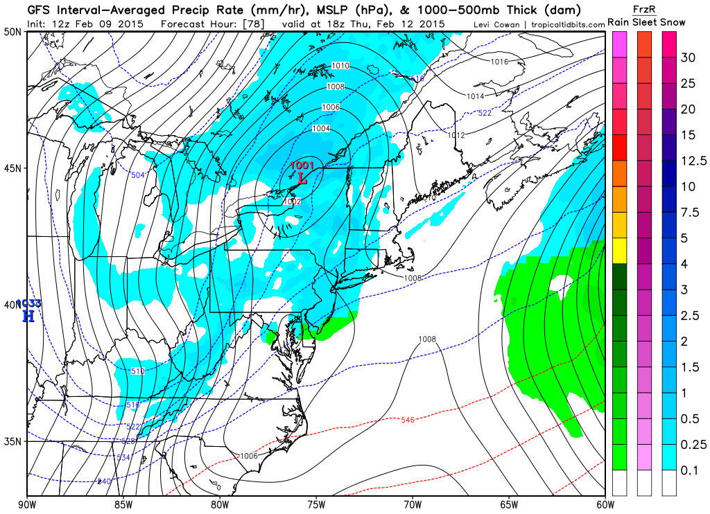
This first period (Thursday morning-afternoon) is showing how far northward the low comes in from the west. It crosses the Great Lakes and hits a wall in upstate NY.
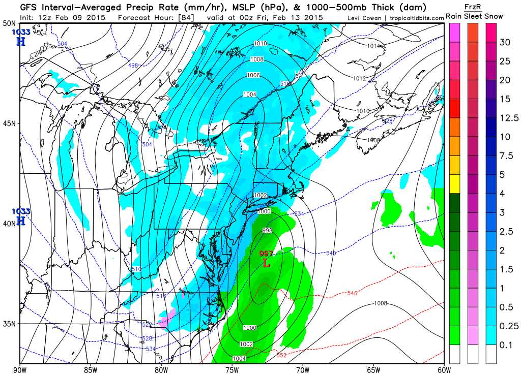
The next period shows how far south the clipper transfers and forms a coastal low. At this point (Thursday afternoon-evening), it’s cold enough for snow in all of New Jersey.
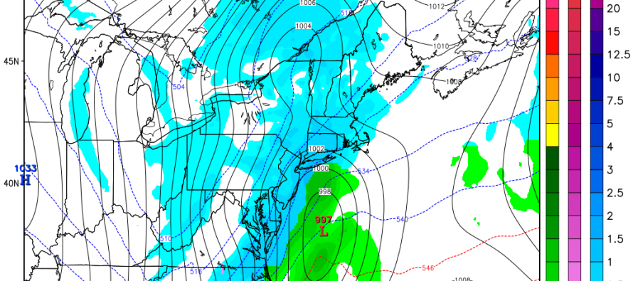
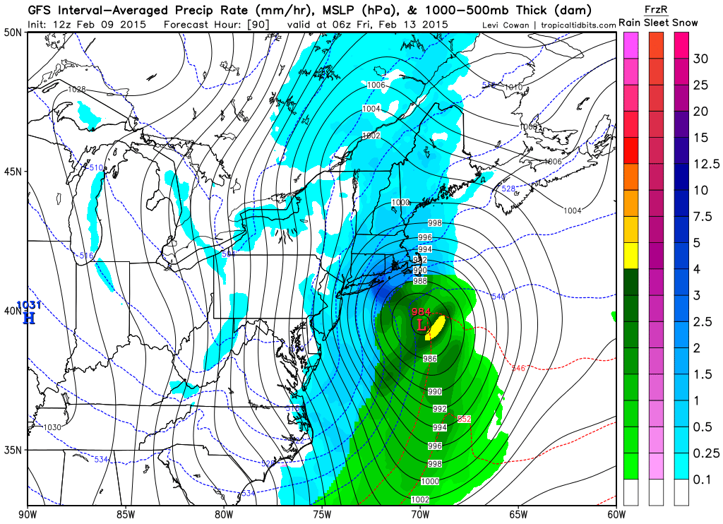
By early AM Friday, the low is rapidly intensifying and pulling away from New Jersey. Bands of snow are still being kicked into New Jersey from the ocean but overall, precipitation is pulling away.
There’s no way I can talk about expected snow accumulations with this volatile of a setup. I’m hesitant to even mention this given recent model performance but I wouldn’t be doing my job if I didn’t—not with the upgraded GFS showing such solution within this time range.
In English: A period of snow is possible from Thursday morning/afternoon until early Friday morning. I’ll be tracking closely given the proximity of the event (less than 100 hours away). Be safe! JC
Model images courtesy of Tropical Tidbits.
Jonathan Carr (JC) is the founder and sole operator of Weather NJ, New Jersey’s largest independent weather reporting agency. Since 2010, Jonathan has provided weather safety discussion and forecasting services for New Jersey and surrounding areas through the web and social media. Originally branded as Severe NJ Weather (before 2014), Weather NJ is proud to bring you accurate and responsible forecast discussion ahead of high-stakes weather scenarios that impact this great garden state of ours. All Weather. All New Jersey.™ Be safe! JC


