Feb 4: Thursday Snow Update

While many eyes are on the Sunday-Tuesday period, including rumor-central, lets get through Thursday first. Model guidance continues to suggest a late phase between northern and southern energy streams. This should happen in time for parts of coastal New England to get a decent snow storm but not New Jersey. We’ll likely be dealing with the northern stream only in the form of an Arctic cold frontal passage. The southern energy will begin forming a coastal disturbance but well to our SE. That’s what will eventually join the northern stream for the coastal New England storm. Today seems toasty after recent cold weather but that’s only because of SW flow ahead of the Arctic cold front. Make no mistake, once the front is through we’re going right back into Old Man Winter’s hands.
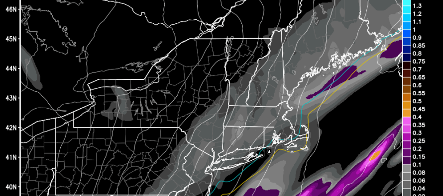
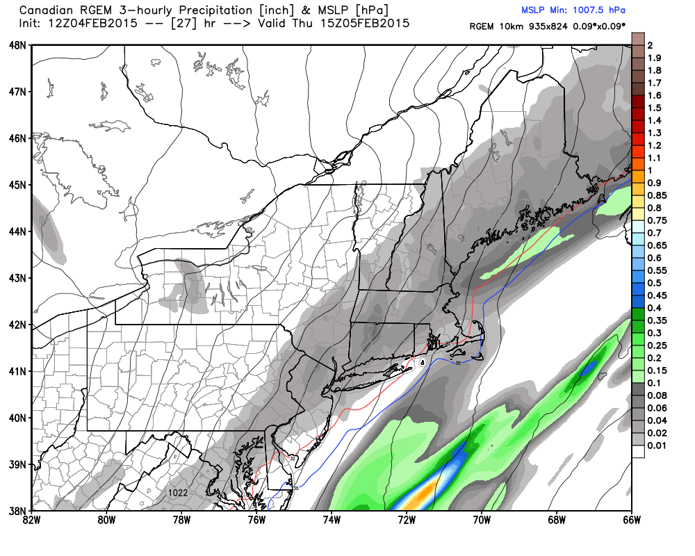
As the Arctic front moves through our region from W/NW to E/SE overnight and tomorrow, precipitation will gather ahead of it—just like warm weather thunderstorms. With that being said, we’re only looking at a thin band of precipitation in the form of light snow. With that being said, anything from a coating to an inch or two is possible for NWNJ and parts of CNJ/NENJ that surrounds the I-95 corridor. Everyone to the SE of I-95 is subject to anything from just flurries to a coating/half-inch. This is not a big deal and not even worth making a snow map for IMO. Here’s the latest Canadian RGEM (850mb temps, pressure and precipitation in liquid inches), a model I find to be more reliable for northern stream influence on the mid-Atlantic US:
I’ll have a detailed analysis posted this evening regarding the Sunday-Tuesday potential. In a nutshell it looks like a prolonged period of on-and-off light-to-moderate snow lasting from Sunday into possibly Tuesday. Some model guidance is suggesting a temperature profile too warm for parts of SNJ resulting in mix/rain. Most model guidance is all snow for CNJ and NNJ. Again, more details to come later this evening but be careful of the rumor bin out there.
In English: Light snow is expected to move into the region from the W/NW overnight and clear by noon-ish tomorrow. It should start between midnight and sunrise. It should all be light and powdery snowfall that yields about a coating to an inch or two at the absolute most. A nuisance event is probably the best description. Snow is also expected in the Sunday-Tuesday period which I’ll speak to in more detail later this evening. Be safe! JC
Jonathan Carr (JC) is the founder and sole operator of Weather NJ, New Jersey’s largest independent weather reporting agency. Since 2010, Jonathan has provided weather safety discussion and forecasting services for New Jersey and surrounding areas through the web and social media. Originally branded as Severe NJ Weather (before 2014), Weather NJ is proud to bring you accurate and responsible forecast discussion ahead of high-stakes weather scenarios that impact this great garden state of ours. All Weather. All New Jersey.™ Be safe! JC


