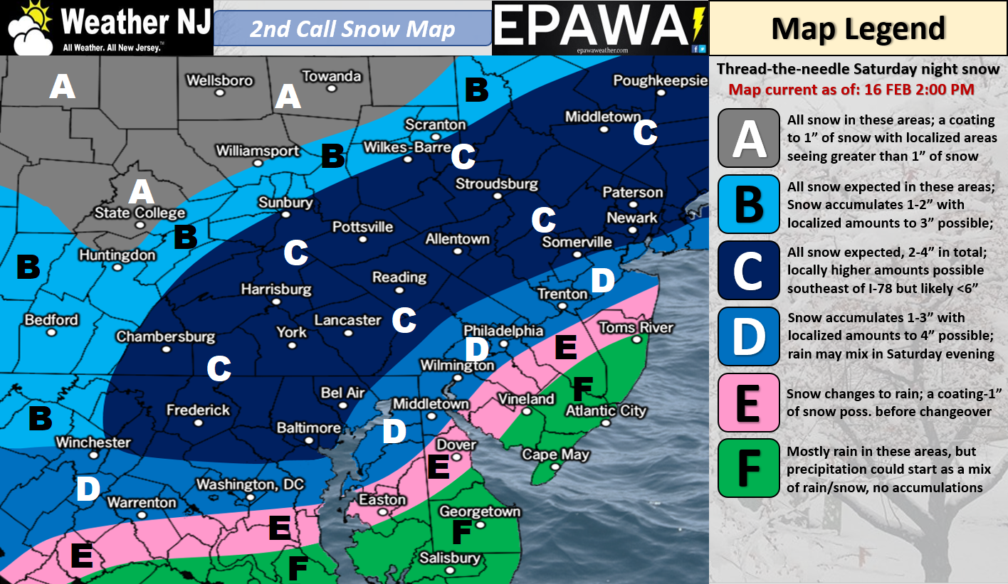
Click here for full-resolution impact map!
Discussion: We’ve beaten this system to death now. It’s a weak wave traversing a frontal boundary that will first be pushed to our S overnight tonight and then brought back up into NJ tomorrow. How far the boundary is pushed back into NJ tomorrow night into Sunday morning will determine where the snow/rain line gets to. Regardless the January 3-4 blizzard area will likely see the most amount of mixing and/or plain rain from this system.
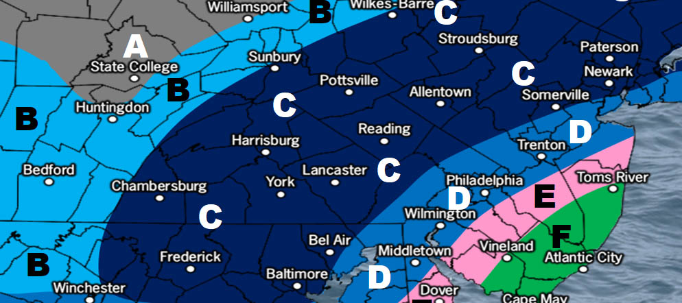
Zones C and D are the highest impact areas for New Jersey. C is a 2-4/3-6″ area and D is a 1-3/2-4″ area. Not a major event but certainly plowable upon snow map verification. This system is a quick mover with marginal temperatures for everyone along and SE of the I-95 corridor. There is a lot working against this storm system to exceed 6 inches in any area of NJ, let alone NNJ.
Expected timing has not changed either. Start time looks like early Saturday evening and end time looks like early Sunday morning. This is our second call snow map and could possibly stand as our final call. We’ll take a look in the morning and make any necessary adjustments.
In English: A light-to-significant snowfall is expected along and NW of the I-95 corridor. A snow/rain mix or even just plain rain only is likely SE of I-95, especially near the coast. Precipitation begins and ends from W to E between early Saturday evening and early Sunday morning. We then clear out and warm up next week with quick meltage of any stickage. Let’s check back tomorrow morning for any necessary updates. Otherwise our impact map above represents our best call. Have a great rest of your Friday and please be safe! JC
For comprehensive and interactive hyper-local analysis that goes way above and beyond the detail of this public forecast, check out our premium services which include text notifications and forum access.
Jonathan Carr (JC) is the founder and sole operator of Weather NJ, New Jersey’s largest independent weather reporting agency. Since 2010, Jonathan has provided weather safety discussion and forecasting services for New Jersey and surrounding areas through the web and social media. Originally branded as Severe NJ Weather (before 2014), Weather NJ is proud to bring you accurate and responsible forecast discussion ahead of high-stakes weather scenarios that impact this great garden state of ours. All Weather. All New Jersey.™ Be safe! JC
