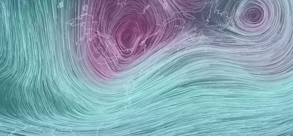
Disco: Two shortwaves have tracked across the US and are now phasing together for another powerful coastal New England storm. Had the phase happened a bit earlier, then New Jersey could have seen a significant to major winter storm. Instead, we’re likely just going to deal with colder temperatures, increased winds and possibly some lighter snow mainly for points NJ points north and west.
Temperatures: As the system wraps up into another sub-980mb storm system near Nova Scotia, it will help pull down a trough of cold air behind it. This cold air mass should impact all of New Jersey tonight through Friday with colder temperatures. Here’s an 850mb depiction of the cold air mass off the latest GFS for Thursday morning at 7AM. For the surface this means slightly below-average temperatures for this time of year (highs in upper-30s/lower-40s and lows in the upper-teens/20s:
Winds: We’ll likely be dealing with winds out of the NW and W/NW (as seen above on the 850mb temperature map). They should begin to pick up later tonight and peak tomorrow before subsiding by Friday. According to the latest model guidance, sustained winds should vary between 18-25mph with gusts to 35mph. A few isolated gusts of 40mph would not surprise me but 30mph+ is should be easily doable. Therefore the winds will be noticeable but not crazy like they were this past Sunday-Monday.
Snow: By no means am I expecting a widespread snow event. However isolated-to-scattered precipitation is starting to move through from the NW. This precipitation is associated with the northern stream system that is currently transferring offshore. It’s moving with a the cold front so mixed precipitation types are possible. I would say NWNJ has the best chance to see snow and SENJ has the best chance to see rain. While impacting accumulations are not likely, visibility could still be reduced beneath a flizzard.
In English: We’ll be colder tonight through Friday. Stronger (but not crazy) winds should pick up tonight and last through tomorrow before calming down Friday. Watch out for smaller pockets of precipitation moving through today-tonight (some snowy). Little to no accumulations are expected but snow could temporarily reduce visibility (NWNJ favored over SENJ). You might even get to experience graupel (they look like Dippin’ Dots). Points S might just see light rain. We’ll then start to moderate Friday evening heading into the weekend. Sunday is looking like the most mild day of the weekend with 60F+ temperatures possible. We’re then mild through next week. I’ll have the detailed weekend outlook posted tomorrow. Have a great day and please be safe! JC
Jonathan Carr (JC) is the founder and sole operator of Weather NJ, New Jersey’s largest independent weather reporting agency. Since 2010, Jonathan has provided weather safety discussion and forecasting services for New Jersey and surrounding areas through the web and social media. Originally branded as Severe NJ Weather (before 2014), Weather NJ is proud to bring you accurate and responsible forecast discussion ahead of high-stakes weather scenarios that impact this great garden state of ours. All Weather. All New Jersey.™ Be safe! JC
