The Polar Vortex is on-deck and ready to bat the entire eastern 2/3 of the US into below-average temperatures. We can expect this to happen starting around December 29th and lasting into January. We’re warm until then and we don’t know how long it will last into January but it is definitely coming!
Starting this weekend, an Arctic high should drop southward from Canada—over the Montana region and all the way to Texas. It should then slide into the Atlantic Ocean well to the south of New Jersey. Associated anti-cyclonic flow (from the high pressure moving through) will team up with the cyclonc flow of “a piece of the Polar Vortex” stationed in E. Canada. This basically means that the Arctic gates will open to the central and eastern US. Let’s look at some European guidance from Tropical Tidbits. This first image represents 850mb temperatures on New Years Day. You can see that New Jersey will have an air-mass overhead that’s negative 15-20C below zero. Remember, 850mb is 5000 feet. At the surface this would translate to highs in the teens and 20s with lows in the single digits and teens. Note the high pressure to our west and south helping to pull the cold Arctic air over the New Jersey region:
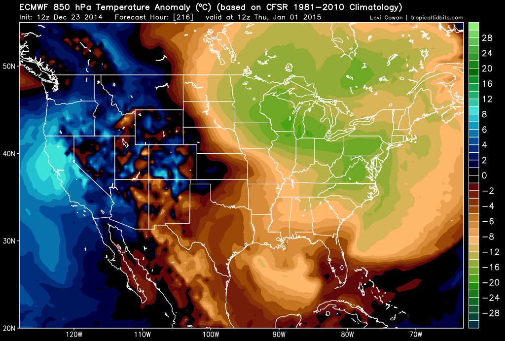
Here is another European model slide, courtesy of Tropical Tidbits, showing 850mb temperature anomalies (departure from average), also on New Years Day. The entire state of New Jersey appears to be -16 degrees below average at 850mb. That should translate to -5 to -10 below average at the surface which for January is cold.
In English: We’re warm with a few rain storms through Christmas and this weekend. Then we will experience Arctic cold starting just before New Years and lasting into early January. Could it remain cold further into January? Sure. Could it moderate again? You bet! The point is that regional temperatures remain uncertain beyond early January. With the cold coming, we will have to pay special attention to any low pressure disturbances that bring precipitation to the region between December 28th and at least January 5th. You know I’ll be tracking. Be safe! JC
Jonathan Carr (JC) is the founder and sole operator of Weather NJ, New Jersey’s largest independent weather reporting agency. Since 2010, Jonathan has provided weather safety discussion and forecasting services for New Jersey and surrounding areas through the web and social media. Originally branded as Severe NJ Weather (before 2014), Weather NJ is proud to bring you accurate and responsible forecast discussion ahead of high-stakes weather scenarios that impact this great garden state of ours. All Weather. All New Jersey.™ Be safe! JC
