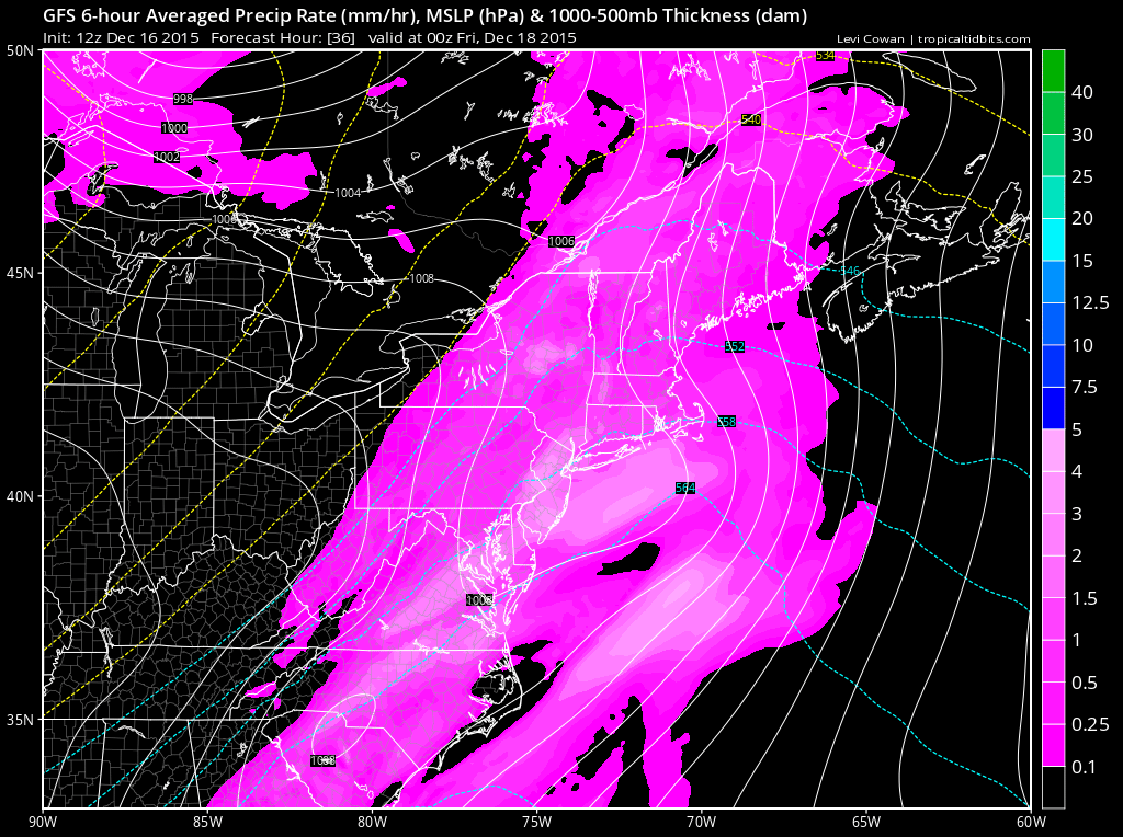
Another low pressure system is spinning from the northern-central US into Canada and dragging a cold front through the eastern US. A surface low pressure disturbance should form out of the Gulf of Mexico and ride this cold front through our region. That should tap plenty of moisture, generate enough frontogenic forcing and make for a rainy Thursday afternoon-evening. As of right now, I would expect rainfall to start tomorrow between late morning and afternoon hours. It should then clear out Thursday overnight into early Friday AM. Here are expected rainfall totals through early Friday morning, via the latest GFS. Most of New Jersey is looking at a ~half-inch:
Once the cold front is through on Friday, our region will dip into much colder temperatures but only for the weekend. Look out for any lake effect flurries that make it to New Jersey. With strong NW flow over the Great Lakes, such is possible but more favored for NWNJ than SENJ.
The warm-up heading into Christmas, with more rain, is still very much on the table. The only trend on recent guidance is that a cold front might come through for Christmas Day. This would leave Christmas Eve still wildly above-average in temperature and subject to pre-frontal rainfall—while leaving Christmas Day cold, clearing and with NW flow.
In English: Expect rain between tomorrow late-morning/afternoon and into early Friday AM. This will precede a cold front that will knock temperatures way down for the weekend. Next week, we moderate again back to mild temperatures and set up yet another frontal passage around the Christmas Eve/Christmas Day period—which should feature rain ahead of it. I’ll have the detailed weekend outlook posted tomorrow evening. Be safe! JC
Model images retrieved from Tropical Tidbits.
Jonathan Carr (JC) is the founder and sole operator of Weather NJ, New Jersey’s largest independent weather reporting agency. Since 2010, Jonathan has provided weather safety discussion and forecasting services for New Jersey and surrounding areas through the web and social media. Originally branded as Severe NJ Weather (before 2014), Weather NJ is proud to bring you accurate and responsible forecast discussion ahead of high-stakes weather scenarios that impact this great garden state of ours. All Weather. All New Jersey.™ Be safe! JC
