Dec 14: Wintry Impact Maps

Discussion: We’re now on the back side of the low that moved through last night through early this morning. Just an isolated chance of showers as we head into overnight hours. We should be cooler and drier on Sunday. Colder W/NW flow will then take temperatures down for Sunday night into Monday.
Another low should track right through New Jersey between Monday-Tuesday. Eventually it will bring temperatures too warm for wintry precipitation for all except the most extreme elevations of Sussex County. But as precipitation moves in just ahead of the initial warm front the moisture will be moving into cold air.
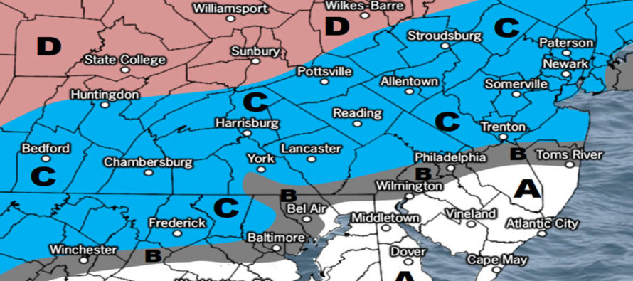
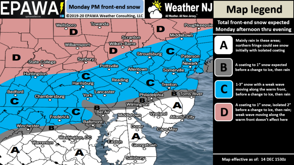
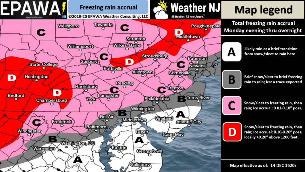
As our impact maps indicate NWNJ is most favored for initial wintry precipitation. SENJ is least favored. This could impact both Monday PM and Tuesday AM rush hours, not with snow accumulations but with icy conditions. I recommend allowing a little more time for your commute.
So it arrives by Monday afternoon and changes over from wintry to non-wintry type precip from S to N through Monday night. It goes to all rain by Tuesday morning for all areas but high elevations of Sussex County. It clears out mid-to-late Tuesday morning. The following maps represent expected snow (top) and ice (bottom).

Click here to view full-resolution snow map!

Click here to view full-resolution snow map!
In English: Wintry precipitation could impact parts of New Jersey this Monday PM through Tuesday AM before likely changing to rain. Our above maps represent our initial thoughts for front-end wintry potential. We’ll update tomorrow if needed. Have a great rest of your Saturday night and please be safe! JC
Download the new free Weather NJ mobile app on Apple and/or Android. It’s the easiest way to never miss Weather NJ content. Our premium services go even further above and beyond at the hyper-local level. Looking for industrial-caliber long-range forecasting data that I personally recommend? Check out WeatherTrends360! Visit the Weather NJ Kaboom Shop for hoodies, tees and infant onesies.
Jonathan Carr (JC) is the founder and sole operator of Weather NJ, New Jersey’s largest independent weather reporting agency. Since 2010, Jonathan has provided weather safety discussion and forecasting services for New Jersey and surrounding areas through the web and social media. Originally branded as Severe NJ Weather (before 2014), Weather NJ is proud to bring you accurate and responsible forecast discussion ahead of high-stakes weather scenarios that impact this great garden state of ours. All Weather. All New Jersey.™ Be safe! JC


