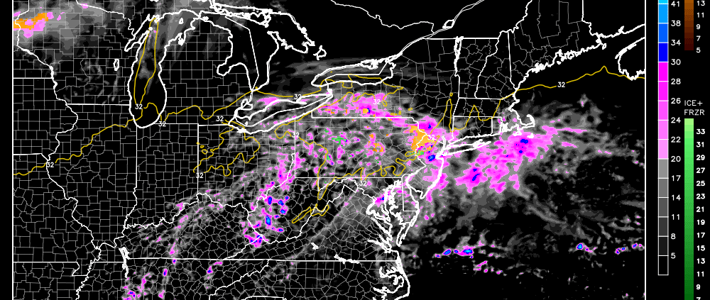
High pressure is currently forcing a cold front southeastward through the region with some precipitation. The cold front will eventually stop and backtrack northwestward as a warm front through tomorrow evening/Wednesday morning. Like tonight, there should be precipitation along that boundary as it moves. This presents a concern for areas that remain below freezing tomorrow at the surface, especially elevations greater than 1,000 ft. Eventually all areas will change over to rain but it could get slippery out there before that happens. With that being said, here’s a map of what I expect tomorrow afternoon into the early hours of Wednesday:
Again, everyone will eventually change over to rain which will wipe out any trace accumulations below 1,000 ft. Most of this is of no concern for the southern 2/3 of New Jersey. For the higher elevations of NWNJ and points NW from there, watch out for a period of sleet and/or freezing rain before changing to rain. This would be due to warmer air moving northward over colder and lower layers of the atmosphere. The precipitation starts as rain up in the higher levels and then cools as it falls through the lower levels. If it freezes before impact it’s sleet. If it freezes after impact, it’s freezing rain. Once everything changes over to rain it should all dry out by noon on Wednesday.
In English: Rain showers should continue to fall this evening and taper off by morning. Tomorrow should me mostly cloudy with more precipitation developing and pushing northward during the afternoon-evening hours. While most of central and southern New Jersey will likely just experience rain, higher elevations of NNJ could see a wintry mix and even some snow accumulation before the changeover. Be safe! JC
Jonathan Carr (JC) is the founder and sole operator of Weather NJ, New Jersey’s largest independent weather reporting agency. Since 2010, Jonathan has provided weather safety discussion and forecasting services for New Jersey and surrounding areas through the web and social media. Originally branded as Severe NJ Weather (before 2014), Weather NJ is proud to bring you accurate and responsible forecast discussion ahead of high-stakes weather scenarios that impact this great garden state of ours. All Weather. All New Jersey.™ Be safe! JC
