CNJ/SNJ Snowstorm Developing

Discussion: A quick recap… We originally (in late-December) identified three potential snow signals within the favorable snow pattern that kicked off Jan 2 and should go through at least Jan 16. The first was last night’s light SNJ snow clipper. We had a general C-1 forecasted across SNJ (S of I-195). Some areas saw it, others did not. Whatever. The second signal was a system within the Jan 4-8 period which will be this Monday. I will cover Monday in detail below. The third signal was between Jan 8-12 which is now starting to show support for the Jan 11-12 window. I won’t touch that one until we are through Monday and only if still showing support. Let’s dive into Monday.
A series of low pressure in SE Canada is spinning and sending flow towards NJ from the N. The storm of interest for Monday, as it tracks across the US closer to NJ, will send flow towards NJ from the S. Where the air flows collide is called a zone of confluence. When air collides linearly like this, it can’t go into the Earth, so it rises and produces a very thin strip of lifting with sinking air on each adjacent side of the confluence known as subsidence. The subsidence zone of sinking air to the S of the confluence zone is what will produce a sharp/steep drop off in snow accumulation somewhere in CNJ/NNJ. It’s a tug of war between the low pressure in SE Canada and the low pressure from the storm itself. Weaker SE Canada low/stronger storm low means a further N snowstorm for NJ. And in opposite, a stronger SE Canada low/weaker storm low situation means the snow does not make it northward into CNJ/NNJ. In the last 3 days, we’ve seen a lot of windshield wiper effect where the axis of the snowstorm’s jackpot shifts N and S by 50-100 miles at a time. This is mainly due to the models varying the intensities of the above-mentioned lows. I think we’re finally reaching a consensus on the exact storm low track and intensity of such. But what is still yet TBD is the extent of precipitation on the N side of the jackpot. This is an overrunning event that typically overpowers confluence but, in this case, the low is a weak low (998-1002mb) setting up a stalemate and keeping the zone of confluence across at least NNJ, possibly some of CNJ on Monday. These have been the main physics we’ve been watching.
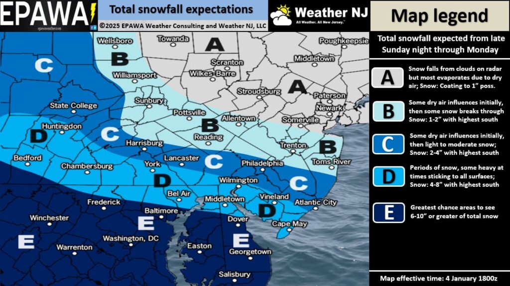
Otherwise, this is a zonal tracking system that entered N California yesterday, off the Pacific Ocean, and is tracking across the US right now. Once it gets to the KY/TN area just after midnight on Monday morning, snow will begin pushing into SWNJ before daybreak Monday morning. As the low then continues E (to the S of NJ) into the Atlantic Ocean, the precipitation shield of snow will expand into CNJ Monday morning into Monday afternoon, possibly some of NNJ but again with a sharp cutoff due to the influence of the confluence and associated subsidence on its S side. The low then pulls away and precipitation ends in NJ from W to E by Monday night. SNJ, especially SWNJ through Cape May, should begin anticipating school closures for plowable snow.
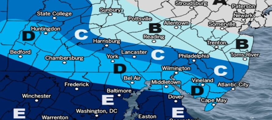
We’ve weighed all model guidance right up through today’s 12Z Euro and have produced the following evidence-based prediction. This is a tough system to forecast with such variation in jackpot axis model suite to model suite. And just 20 miles N or S can mean the difference in brining huge populations into or out of the heavier snow. With that said, here is our initial snow map. We’ll update tomorrow if we have to before live observations begin late tomorrow night into Monday morning.

Once the system clears out Monday night, we’re in for a 3rd gear of cold from the Arctic. Tuesday through Friday looks very cold and dry. Then all eyes will turn to the weekend coastal snowstorm potential if still showing.
In English: We’re cold and dry through Sunday night. Snow should push into SWNJ before sunrise Monday morning, expand into the rest of SNJ and CNJ between mid-to-late Monday morning and Monday afternoon, and then end for all of NJ by Monday evening. I’d say first SWNJ flakes could be around 3-4AM Monday morning with last flakes for ECNJ/SENJ around midnight Monday night into Tuesday. Peak snowfall intensity should occur between about 8am and 4pm on Monday. That’s the best timing we can do from this range. We hope to drill down further on timing with tomorrow’s final update before the storm. Have a great rest of your Saturday and please be safe! JC
Premium Services
KABOOM Club offers ad-free content, inside info forecast discussion, your questions answered, and early storm impact maps and video releases (ahead of the public). At two bucks per month, it’s an extremely feasible way to show additional support for Weather NJ. Think of it as a tip jar with perks. Available onFacebook or Patreon.
My Pocket Meteorologist (MPM), in partnership with EPAWA Weather Consulting, offers professional/commercial interests, whose businesses depend on outdoor weather conditions (snow plowing, landscaping, construction, etc.), with hyper-local text message alerts/forecasts and access to the MPM premium forum—the most comprehensive and technical forecast discussion available for PA and NJ.
Jonathan Carr (JC) is the founder and sole operator of Weather NJ, New Jersey’s largest independent weather reporting agency. Since 2010, Jonathan has provided weather safety discussion and forecasting services for New Jersey and surrounding areas through the web and social media. Originally branded as Severe NJ Weather (before 2014), Weather NJ is proud to bring you accurate and responsible forecast discussion ahead of high-stakes weather scenarios that impact this great garden state of ours. All Weather. All New Jersey.™ Be safe! JC


