Christmas Weather Looks Like a Hot Mess

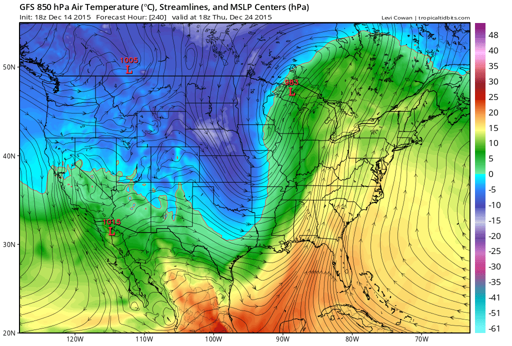
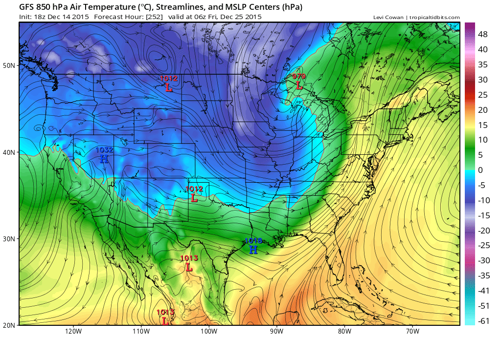
This weekend remains modeled as a transient cold shot of air. Next week however and into Christmas looks incredibly warm for late December. After the cold moves through, high pressure should then position itself off the mid-Atlantic coast as another strong low pressure system cuts into the Great Lakes. The two synoptic systems will bring warm southerly flow across our region and most of the E. coast (similar to what happened these past few days). Therefore we’re looking at temperatures possibly in the 60s and even 70s again heading into ~Christmas Eve-Christmas Day. Here’s some supporting guidance for the temperature profiles (850mb temps) for Christmas Eve heading overnight into Christmas Day:
Temperature profiles and trends are as specific as I want to get for the period heading into Christmas. Model guidance is extremely uncertain from this range (10 days out) when it comes to specific daily conditions (rain/sun/etc). Temperature profiles however from pattern synoptics are more confident at this point. So let’s forget about the widespread rainfall modeled around that time period as well. As I said, Christmas looks like a hot mess. That low will likely occlude into S. Canada again which should bring rain through the E. coast ahead of it’s cold front. The specific timing of the rain will have to be analyzed withing the mid-to-long range forecasting period later this weekend.
In English. This weekend will feel noticeably colder. Next week heading into Christmas should feel very warm again with more rain possible. The warmth is becoming a more confident forecast. Timing of the rain will have to be tracked closer to the event. There are many travel interests for this period so I will make sure to have a detailed outlook posted by this Sunday. Let’s see how everything looks then. Be safe! JC
Photo Credit: National Lampoon’s Christmas Vacation. Warner Bros. 1989. Retrieved from Google Image’s search results using the “labeled for reuse” filter. Model images retrieved from Tropical Tidbits.
Jonathan Carr (JC) is the founder and sole operator of Weather NJ, New Jersey’s largest independent weather reporting agency. Since 2010, Jonathan has provided weather safety discussion and forecasting services for New Jersey and surrounding areas through the web and social media. Originally branded as Severe NJ Weather (before 2014), Weather NJ is proud to bring you accurate and responsible forecast discussion ahead of high-stakes weather scenarios that impact this great garden state of ours. All Weather. All New Jersey.™ Be safe! JC


