Back to homepage

Latest NJ Weather Alerts

Transitional Conditions Continue (Sept 24-28)

Transitional Conditions Continue (Sept 24-28)

🕔17:00, 23.Sep 2018

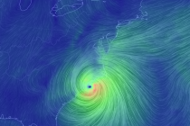
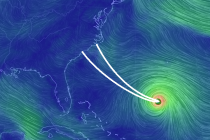
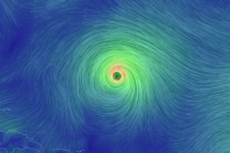
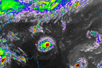
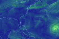
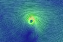
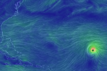
Discussion: Upper-level 500mb heights will build into a ridge over the Northeast US this week. This should bring swampy south flow at the surface to New Jersey, especially as a small piece of remnant tropical energy feeds into the flow

Read Full Article
Warm Humid Start. Comfortable Finish (Sept 21-23)

Warm Humid Start. Comfortable Finish (Sept 21-23)

🕔13:59, 20.Sep 2018

Discussion: Upper-level ridging, currently over the E US, should be flattened by a shallow upper-level Canadian disturbance this weekend. At the surface this should produce a warm and humid Friday running into the first part of Saturday. By Saturday evening,

Read Full Article
Wet Start to the Week (Sept 17-21)

Wet Start to the Week (Sept 17-21)

🕔18:30, 16.Sep 2018

Discussion: Florence has been nearly stationary under the ridge all weekend with no escape path until now. Finally the jet stream will pick up Florence’s remnants and take them over the Mid-Atlantic and Northeast US between Monday and Tuesday. For

Read Full Article
Side Effects of Florence (Sept 14-16)

Side Effects of Florence (Sept 14-16)

🕔17:49, 13.Sep 2018

Discussion: Hurricane Florence is stuck directly under the ridge now as it crawls into coastal NC. A slow-to-depart upper-level low to the SW of Florence resulted in some weakening yesterday. That and a failed Eye Wall Replacement Cycle (EWRC). For

Read Full Article
Sept 11: Florence to Spare New Jersey

Sept 11: Florence to Spare New Jersey

🕔16:45, 11.Sep 2018

Discussion: I’ve seen enough to remove the landfall potential for New Jersey and likely even Delmarva. I’m 90%-plus confident that landfall will occur between the SC/NC border and Cape Lookout, NC (the track indicated in the above cover image). I

Read Full Article
Sept 10: Dangerous East Coast Impact Likely

Sept 10: Dangerous East Coast Impact Likely

🕔20:27, 10.Sep 2018

Discussion: Major Hurricane Florence is packing 140mph sustained winds with a central pressure below 940mb now. This category 4 hurricane is currently located at 25.4N 61.1W and moving W/NW at 13mph per the National Hurricane Center. Little shear and warm

Read Full Article
Sept 9: East Coast Landfall Likely

Sept 9: East Coast Landfall Likely

🕔17:14, 9.Sep 2018

Discussion: Per the latest 5pm update from the National Hurricane Center, Hurricane Florence is now located at ~24.4N 57W and moving W at 7mph. Flight recon shows a central pressure of 975mb and sustained winds of 85mph. The hopeful escape to

Read Full Article
Sept 8: Concerns Grow for East Coast Landfall

Sept 8: Concerns Grow for East Coast Landfall

🕔16:27, 8.Sep 2018

Discussion: Florence is now located at ~25N 55W (~700 miles SE of Bermuda) and moving very slowly to the W. It is still a strong tropical storm but expected to re-intensify into a hurricane as early as overnight tonight but

Read Full Article
Sept 6: Florence Threat Increasing

Sept 6: Florence Threat Increasing

🕔21:49, 6.Sep 2018

Discussion: Florence, currently located at 25N 49.6W, has taken a substantial beating from the wind shear mentioned in last night’s article. There’s a chance it might even dip down to Tropical Storm status overnight into tomorrow. Unfortunately this is not

Read Full Article
Sept 5: Watching Florence

Sept 5: Watching Florence

🕔21:28, 5.Sep 2018

Discussion: Major Hurricane Florence is currently located at 23N 47W. It’s packing sustained winds of 130mph and is tracking towards the general Bermuda region. Florence’s first hurdle, when we last discussed, were cooler sea surface temperatures W/SW of the Cape

Read Full Article