Back to homepage

Latest NJ Weather Alerts

April 9: Saturday Morning Observations

April 9: Saturday Morning Observations

🕔11:40, 9.Apr 2016

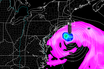
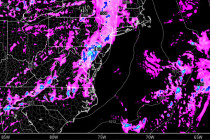
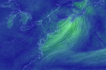
Precipitation, associated with the low pressure system currently heading out to sea, has moved into the area. You can see the low pressure center over NJ on the above Earth Map image. That will continue heading east while leaving an elongated

Read Full Article
Colder Weekend Expected (April 8-10)

Colder Weekend Expected (April 8-10)

🕔11:26, 8.Apr 2016

This weekend will feature cold overnight temperatures and cool daytime high temperatures with nuisance wintry precipitation possible. Let’s break it down: Friday (April 8) high temperatures should reach the upper-40s for NNJ elevations and lower-50s for the rest of New

Read Full Article
April 7: Say it ain’t Snow

April 7: Say it ain’t Snow

🕔11:04, 7.Apr 2016

We’re still looking at a major pattern change toward warm and mild weather for the second half of April. This weekend however looks cold and possibly snowy as indicated on the latest GFS (Saturday afternoon-evening): The teleconnections are actually very

Read Full Article
April 6: Rain Approaching

April 6: Rain Approaching

🕔20:55, 6.Apr 2016

Low pressure currently over the Great Lakes is on its way to our region. It will quickly jump to the NJ area tomorrow and then lift to the N out of our region by Friday afternoon. This should bring some

Read Full Article
Long Range Outlook – Through April 2016

Long Range Outlook – Through April 2016

🕔14:07, 5.Apr 2016

It’s time to harness the WeatherTrends360 proprietary weather algorithms to see how the rest of April 2016 should play out. But first lets break New Jersey into proper climatological regions. We have the higher elevations of NNJ/NWNJ, the interior coastal plain (SWNJ through

Read Full Article
Another See-Saw Week Expected (April 4-8)

Another See-Saw Week Expected (April 4-8)

🕔21:38, 3.Apr 2016

The active weather pattern should continue this week. Let’s break it down. The winds have finally calmed down statewide. Precipitation however is possible later tonight into tomorrow from another passing low pressure system. NNJ could see snowfall, especially elevations, while

Read Full Article
April 2: Listen to the Wind Blow. Watch the Sunrise!

April 2: Listen to the Wind Blow. Watch the Sunrise!

🕔12:14, 2.Apr 2016

Those are some of my favorite Fleetwood Mac lyrics and are well-suited for tomorrow morning. A low pressure disturbance, currently over the Great Lakes, will be making a pass through our region overnight. It should track right over the NNJ/NYC area in

Read Full Article
I’ve Seen Better Weekends (April 1-3)

I’ve Seen Better Weekends (April 1-3)

🕔09:05, 1.Apr 2016

The weather looks very active this weekend in New Jersey. Lots of dynamics at play as we transition from mild and stormy to cold and dry. The main player for today is a low pressure system passing far to our

Read Full Article
Mar 31: Rain and Possible Storms Approaching

Mar 31: Rain and Possible Storms Approaching

🕔12:59, 31.Mar 2016

Radar confirms that precipitation has made it into W. PA. It will continue to push east and bring rainfall to New Jersey later tonight through Friday evening. I wish I could say just some wind and rain but the dynamics are potentially

Read Full Article
Mar 30: Friday Looks Disruptive

Mar 30: Friday Looks Disruptive

🕔21:01, 30.Mar 2016

A cold air mass is coming. A series of low pressure systems will ride the front of the upper-level trough as it swings its axis into a negative tilt. Precipitation should form along the entire front side of the trough

Read Full Article