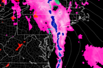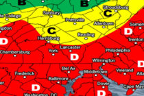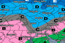
Mild and Wet for Most (Feb 3-7)
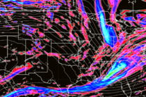
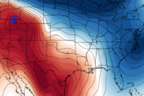
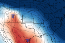
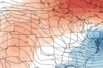
Discussion: In the upper-levels, anomalous ridging should dominate the pattern for the next 10 days. In some cases the ridging retrogrades W enough to pull some troughing down from SE Canada over our area. At the surface this means a