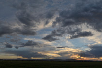
Mild Start. Cooler Finish (March 20-22)
Discussion: The upper-level jet should push to the N of NJ on Friday as 500mb ridging flexes. The jet should then sink to the S of NJ for the rest of the weekend as geopotential heights relax but still remain
Discussion: A strong zonal upper-level jet will dominate the 250mb space over NJ this weekend. 500mb geopotential height anomalies will remain positive with a weak upper-level trough moving through SE Canada. There will be a strong surface low under that
We’re seeing a lot of conflicting information and fear mongering in the media about the COVID-19 coronavirus. This article is intended to inform our readers of facts and provide an educated response to questions we’ve received regarding weather and its
Discussion: A very dynamic upper-level interaction should occur between an incoming transient trough and a southern stream shortwave this Friday-Sat AM. Right now the southern energy is expected to race ahead of the trough on Friday bringing warmer rain and
It’s time to harness WeatherTrends360 technology and look at how the rest of March 2020 should play out. WeatherTrends360 algorithms are documented with an 84% verification rate and are based on oceanic water cycles, time table series and very complex
Discussion: The Mid-Atlantic US should be dominated by converging upper-level jets in a progressive and zonal pattern through at least Thursday this week. We’ll then see a dip in the upper-level jet for Friday-Saturday which will naturally form an upper-level
Discussion: The 250mb jets (Polar and Pacific) are converging to the SW of NJ and keeping the overall jet pattern S of NJ this weekend. The jet should rise back over and N of NJ by Tuesday followed by a
Discussion: The upper-level (250mb) jet looks very aggressive over the Mid-Atlantic and NorthEast US this Wednesday overnight into Thursday morning. I see a strong jet streak with ample divergence and difluence aloft. This was the signal I mentioned last week.
Discussion: Another very positive-tilted upper-level trough will swing through over the next few days before giving way back to above-average geopotential heights Saturday into the first half of next week. That should put NJ inside the trough tonight through tomorrow
Discussion: A positive-tilted and progressive trough is currently swinging through the region and should give way to the front side of a ridge with upper-level NW flow. This is responsible for bringing the colder conditions that started last night (Thursday)