Back to School Weather? Already! (July 16-19)

With the invasion of an unseasonably cool air mass, that’s the best way I can describe the next few. Growing up I remember the specific feeling at the bus stop in New Jersey. Even though I knew it would it would get warmer later in the day, the morning was cool and comfortable. If you don’t mind sharing this feeling with me, that’s how tomorrow, Friday and possibly Saturday morning should feel when you first step outside. I’m expecting highs around 80 and lows around 60 with lower humidity—very pleasant.
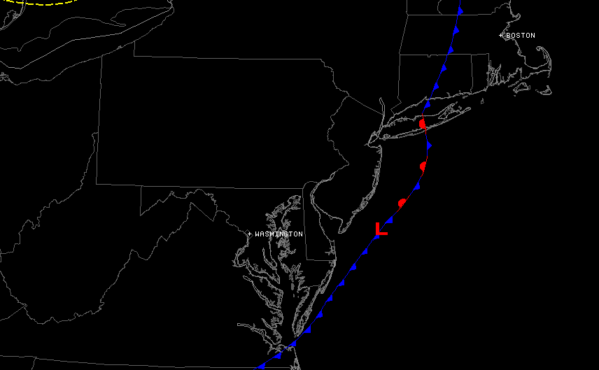
All showers and storms have moved offshore thanks to cold front leading this cooler pool of air across the US. Here is the current location of the frontal boundary via SimuAwips. There is a low riding the boundary forcing a portion to remain stationary but the high pressure to our west will push this out further as today progresses:
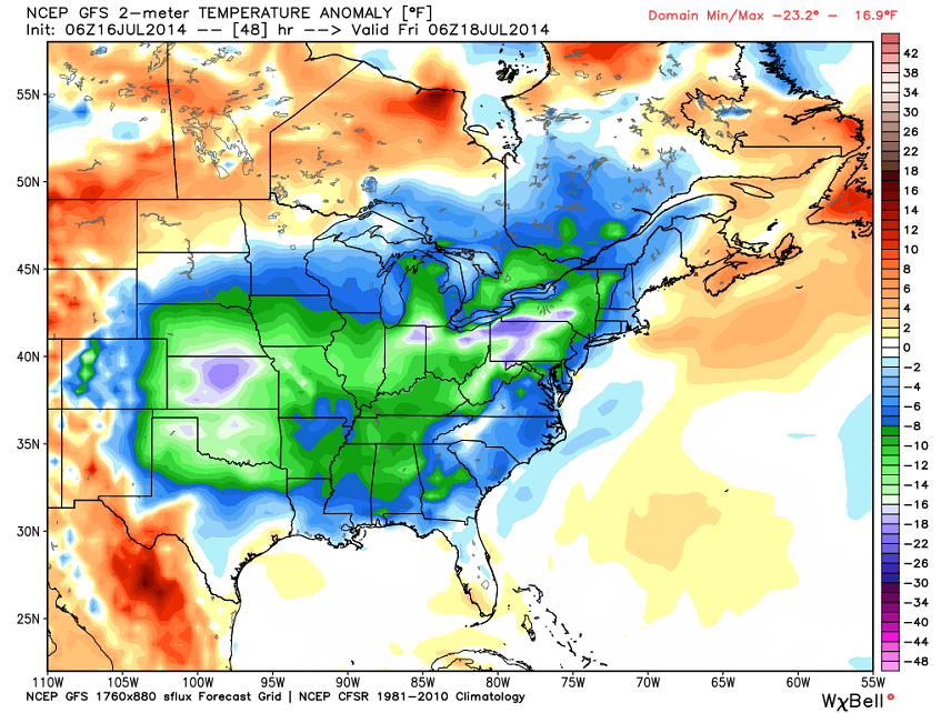
There’s a lot of public debate whether or not this is the polar vortex or not and how cold it’s going to get. It’s really not that big of a deal. A high of 80F/low of 60F is a far cry from a high of 16F/low of -12 like we saw this winter when the polar vortex truly impacted us. This, at best, can be called an outer fringe element of the polar vortex that displaced and dropped on the eastern US for a few days. I assure you that July sun will quickly moderate this air mass for the weekend, especially when winds return to a S/SW flow on Saturday. Here is the GFS showing surface temperature anomalies (departures from average) early Friday morning. It looks like the coast will only be a few degrees cooler than average while NWNJ drops to as much as 10-12 degrees below average:
In English: Expect beautiful September-like weather today through Saturday. Again, expect highs around 80 and lows around 60 with a dry and pleasant feel. Humidity should then return to close out the weekend. I’ll have a fully detailed weekend outlook posted tomorrow night. In the meantime enjoy this back to school-like weather and be safe! JC
Jonathan Carr (JC) is the founder and sole operator of Weather NJ, New Jersey’s largest independent weather reporting agency. Since 2010, Jonathan has provided weather safety discussion and forecasting services for New Jersey and surrounding areas through the web and social media. Originally branded as Severe NJ Weather (before 2014), Weather NJ is proud to bring you accurate and responsible forecast discussion ahead of high-stakes weather scenarios that impact this great garden state of ours. All Weather. All New Jersey.™ Be safe! JC


